6265 Saunders St Flushing, NY 11374-1568
Property profile & analytics
6265 Saunders St, Flushing, NY 11374-1568
- Apartment buildings
- 101,304 SF
- 0.70 lot acres
Property ID
US63-3019331
The Realmo ID is a unique identifier assigned to every property, incorporating country codes and precise geo-coordinates for 300x300-foot land blocks. It enables standardized data collection and seamless integration of disparate sources such as ownership, tax, title data and physical specifications. By aggregating current and historical records, the Realmo ID powers advanced analytics and delivers deep, verifiable insights for real estate professionals.
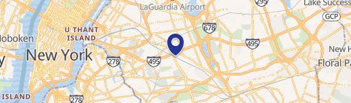
Location Intelligence
Current Use by Public Records
- Apartment buildings
Property Details for 6265 Saunders St
- Year built
- 1941
- Lot size
- 0.70 lot acres
- Zone code
- R7-1
- Property type
- Apartment buildings
- APN
- 03078-0065
- APU
- 30780065
Sales History
| Date | Price | Buyer | Seller | Deed Type | Mortgage |
|---|---|---|---|---|---|
| Dec 1, 2010 | — | Rego Realty LLC | — | Deed Of Trust · related | $7.3M · Prudential Insurance Co |
| — | — | Rego Realty LLC | — | Loan Modification · related | $7.3M · Prudential Insurance Co Americ |
| — | — | Rego Realty LLC | — | Deed Of Trust · related | $5M · Prudential Insurance Co Americ |
| — | — | Rego Realty LLC | — | Deed Of Trust · related | $354k · Prudential Insurance Co |
Value Estimations
based on Realmo’s proprietary methodology
-
Comparable approach
- Method
- Estimation
- Statistic Estimate
- $20,716,000
Market price range: $16.1M - $30.5M -
Alternative Use
- Use
- Estimation
- APARTMENT HOUSE (5+ UNITS)
- $22,510,000 Current use
Get a detailed, property-specific estimation — fast and free
Location Insight
- Map
- Local Demand
- City
- Flushing
- County
- Queens
- State
- New York
- Longitude
- -73.8666
- Latitude
- 40.7309
- CBSA code
- 35620
- CBSA name
- NEW YORK-NORTHERN NEW JERSEY-LONG ISLAND, NY-NJ-PA METROPOLITAN STATISTICAL AREA
Property Tax & Assessments
Tax date
Tax Amount
Assessed Land Value
Assessed Improvement Value
Total Assessed Value
Applied Tax Rate
Land Market Value
Improvement Market Value
Total Market Value
2024
$564,572
$818,100
$4,028,850
$4,846,950
-
$1,818,000
$8,953,000
$10,771,000