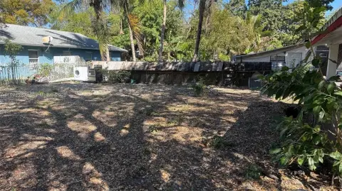
615 82nd Ter Miami, FL 33138-4109
Property profile & analytics
615 82nd Ter, Miami, FL 33138-4109
- Commercial land
- 0.13 lot acres
Property ID
US19-0336257
The Realmo ID is a unique identifier assigned to every property, incorporating country codes and precise geo-coordinates for 300x300-foot land blocks. It enables standardized data collection and seamless integration of disparate sources such as ownership, tax, title data and physical specifications. By aggregating current and historical records, the Realmo ID powers advanced analytics and delivers deep, verifiable insights for real estate professionals.
Location Intelligence
Current Use by Public Records
- Commercial land
Property Details for 615 82nd Ter
- Lot size
- 0.13 lot acres
- Zone code
- 6100:COMMERCIAL,NEIGHBRHD
- Property type
- Commercial land
- APN
- 01-3207-016-0380
- APU
- 132070160380
Sales History
| Date | Price | Buyer | Seller | Deed Type | Mortgage |
|---|---|---|---|---|---|
| Jan 20, 2004 | $225,000 | Miami Lots LLC | Ross,gerald D & Frances M | Grant Deed | $180k · Mellon United National Bank |
| Jul 22, 1999 | $723,600 | Gerald D Ross | Melstine Corp Nv | Grant Deed | $175k · Melstine Corporation |
Value Estimations
based on Realmo’s proprietary methodology
-
AI approach
-
CAP approach
-
Comparable approach
-
Alternative Use
Get a detailed, property-specific estimation — fast and free
Location Insight
- Map
- Local Demand
- City
- Miami
- County
- Miami-dade
- State
- Florida
- Longitude
- -80.1842
- Latitude
- 25.8511
- CBSA code
- 33100
- CBSA name
- MIAMI-FORT LAUDERDALE-MIAMI BEACH, FL METROPOLITAN STATISTICAL AREA
Property Tax & Assessments
Tax date
Tax Amount
Assessed Land Value
Assessed Improvement Value
Total Assessed Value
Applied Tax Rate
Land Market Value
Improvement Market Value
Total Market Value
2023
$9,424
$841,500
$0.00
$841,500
-
$841,500
$0.00
$841,500