610 Shoop Dr Penrose, CO 81240-9523
Property profile & analytics
610 Shoop Dr, Penrose, CO 81240-9523
- Manufacturing properties
- 3,920 SF
- 2.38 lot acres
Property ID
US13-0984522
The Realmo ID is a unique identifier assigned to every property, incorporating country codes and precise geo-coordinates for 300x300-foot land blocks. It enables standardized data collection and seamless integration of disparate sources such as ownership, tax, title data and physical specifications. By aggregating current and historical records, the Realmo ID powers advanced analytics and delivers deep, verifiable insights for real estate professionals.
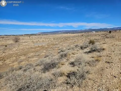
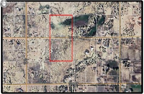
Location Intelligence
Current Use by Public Records
- U-Haul Neighborhood Dealer / Car Rental Facility
- Ethel's collision care center / Auto Repair Shop
Property Details for 610 Shoop Dr
- Year built
- 1987
- Lot size
- 2.38 lot acres
- Property type
- Manufacturing properties
- APN
- 99004137
- APU
- 99004137
Sales History
| Date | Price | Buyer | Seller | Deed Type | Mortgage |
|---|---|---|---|---|---|
| Sep 8, 2025 | $325,000 | Anthony Reed | Michael Devriendt | Warranty Deed | $325k · Michael Devriendt Etal |
| Jul 7, 2014 | $131,000 | Michael Devriendt | Miles L Daffron | Warranty Deed | $80k · Canon National Bank |
Value Estimations
based on Realmo’s proprietary methodology
-
AI approach
-
CAP approach
-
Comparable approach
-
Alternative Use
Get a detailed, property-specific estimation — fast and free
Location Insight
- Map
- Local Demand
- City
- Penrose
- County
- Fremont
- State
- Colorado
- Longitude
- -105.116
- Latitude
- 38.4351
- CBSA code
- 15860
- CBSA name
- CANON CITY, CO MICROPOLITAN STATISTICAL AREA
Property Tax & Assessments
Tax date
Tax Amount
Assessed Land Value
Assessed Improvement Value
Total Assessed Value
Applied Tax Rate
Land Market Value
Improvement Market Value
Total Market Value
2023
$3,327
$0.00
$0.00
$55,445
-
$0.00
$0.00
$198,725