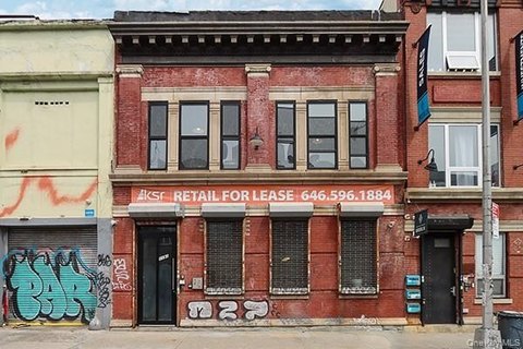
553 Nostrand Ave Brooklyn, NY 11216-3107
Property profile & analytics
553 Nostrand Ave Brooklyn, NY 11216-3107
- Retail residential properties
- 13,740 SF
- 0.10 lot acres
Property ID
US63-5631559
The Realmo ID is a unique identifier assigned to every property, incorporating country codes and precise geo-coordinates for 300x300-foot land blocks. It enables standardized data collection and seamless integration of disparate sources such as ownership, tax, title data and physical specifications. By aggregating current and historical records, the Realmo ID powers advanced analytics and delivers deep, verifiable insights for real estate professionals.
Location Intelligence
Current Use by Public Records
- Retail residential properties
Property Details for 553 Nostrand Ave
- Year built
- 1910
- Lot size
- 0.10 lot acres
- Property size
- 13,740 SF
- Zone code
- R6A
- Property type
- Retail residential properties
- APN
- 01201-0004
- APU
- 12010004
Value Estimations
based on Realmo’s proprietary methodology
-
Alternative Use
- Use
- Estimation
- COMMERCIAL (GENERAL)
- $6,095,000 Current use
- APARTMENT HOUSE (5+ UNITS)
- $4,995,000 Change: -18% Conversion: Moderate
Get a detailed, property-specific estimation — fast and free
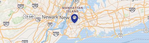
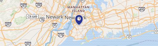
Location Insight
- Map
- Local Demand
- City
- Brooklyn
- County
- Kings
- State
- New York
- Longitude
- -73.9494
- Latitude
- 40.6782
- CBSA code
- 35620
- CBSA name
- NEW YORK-NORTHERN NEW JERSEY-LONG ISLAND, NY-NJ-PA METROPOLITAN STATISTICAL AREA
Property Tax & Assessments
Tax date
Tax Amount
Assessed Land Value
Assessed Improvement Value
Total Assessed Value
Applied Tax Rate
Land Market Value
Improvement Market Value
Total Market Value
2024
$71,822
$26,100
$771,300
$797,400
-
$58,000
$1,714,000
$1,772,000