550 43Rd St Miami, FL 33126
Property profile & analytics
550 43Rd St Miami, FL 33126
- Small apartment buildings
Property ID
US18-6207252
The Realmo ID is a unique identifier assigned to every property, incorporating country codes and precise geo-coordinates for 300x300-foot land blocks. It enables standardized data collection and seamless integration of disparate sources such as ownership, tax, title data and physical specifications. By aggregating current and historical records, the Realmo ID powers advanced analytics and delivers deep, verifiable insights for real estate professionals.
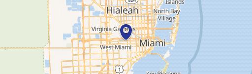
Location Intelligence
Current Use by Public Records
- Small apartment buildings
Property Details for 550 43Rd St
- Year built
- 1930
- Property type
- Small apartment buildings
Description
This charming 1-story, 1930-built duplex in Miami's desirable Waterman Park neighborhood presents a unique investment opportunity. Located at 550 NW 43rd Street, Miami, FL 33126, this property boasts a spacious 4-bedroom, 3-bathroom layout, complete with two full kitchens. Ideal for a large family or savvy investor, the property's versatility is enhanced by its single-family home zoning within a duplex zoning area, opening doors to significant income potential. Projected annual Airbnb income is estimated at $93,500. Recent upgrades include a new roof, updated air conditioning system, modern kitchen cabinets, and new appliances, minimizing immediate maintenance needs. The property offers convenient access to Miami International Airport, Downtown Coral Gables, Downtown Miami, major highways, and the new Inter Miami CF stadium. There are no HOA fees. This property is FHA and VA loan-approved, making financing readily accessible. Don't miss this chance to acquire a well-maintained, high-yield property in a thriving Miami location. The property's location and features combine to create a compelling investment opportunity with strong potential for both short-term and long-term returns. Schedule a viewing to explore this exceptional property's full potential.
Value Estimations
based on Realmo’s proprietary methodology
-
AI approach
-
CAP approach
-
Comparable approach
-
Alternative Use
Get a detailed, property-specific estimation — fast and free
Location Insight
- Map
- Local Demand
- City
- Miami
- County
- Miami-Dade
- State
- Florida
- Longitude
- -80.2667527
- Latitude
- 25.7776958