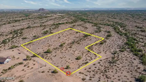
53511 Mcdavid Rd Maricopa, AZ 85139-2745
Property profile & analytics
53511 Mcdavid Rd, Maricopa, AZ 85139-2745
- Commercial real estate
- 3,990 SF
- 100.00 lot acres
Property ID
US07-0851458
The Realmo ID is a unique identifier assigned to every property, incorporating country codes and precise geo-coordinates for 300x300-foot land blocks. It enables standardized data collection and seamless integration of disparate sources such as ownership, tax, title data and physical specifications. By aggregating current and historical records, the Realmo ID powers advanced analytics and delivers deep, verifiable insights for real estate professionals.
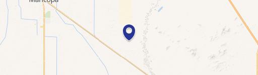
Location Intelligence
Current Use by Public Records
- Millar Airport-2AZ4 / Airport
Property Details for 53511 Mcdavid Rd
- Year built
- 1991
- Construction
- CONCRETE
- Lot size
- 100.00 lot acres
- Property type
- Commercial real estate
- APN
- 510-04-010J
- APU
- 51004010J
Sales History
| Date | Price | Buyer | Seller | Deed Type | Mortgage |
|---|---|---|---|---|---|
| Dec 23, 2019 | — | Millar Trust | Charles R Millar | Quit Claim Deed · related | — |
| Feb 15, 2019 | — | Ide Family Living Trust | Ide,daniel W | Quit Claim Deed · related | — |
Value Estimations
based on Realmo’s proprietary methodology
-
Alternative Use
- Use
- Estimation
- COMMERCIAL (GENERAL)
- $615,000 Current use
- OFFICE BUILDING
- $545,000 Change: -11% Conversion: Easy
- RETAIL STORES
- $525,000 Change: -14% Conversion: Easy
Get a detailed, property-specific estimation — fast and free
Location Insight
- Map
- Local Demand
- City
- Maricopa
- County
- Pinal
- State
- Arizona
- Longitude
- -112.146
- Latitude
- 33.0545
- CBSA code
- 38060
- CBSA name
- PHOENIX-MESA-SCOTTSDALE, AZ METROPOLITAN STATISTICAL AREA
Property Tax & Assessments
Tax date
Tax Amount
Assessed Land Value
Assessed Improvement Value
Total Assessed Value
Applied Tax Rate
Land Market Value
Improvement Market Value
Total Market Value
2023
$7,011
$98,187
$54,640
$152,827
-
$545,486
$303,554
$849,040