Property profile & analytics
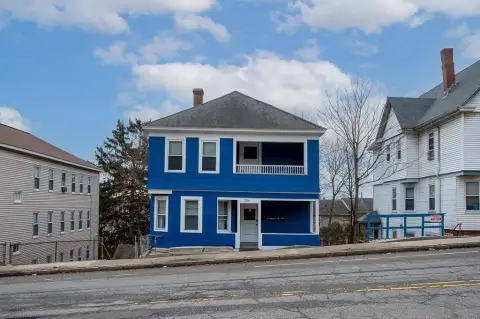
527 Grafton St Worcester, MA 01604-4745
- Commercial real estate
- 1,795 SF
- 0.34 lot acres
OFF-MARKET
Value Estimations
Cap Rate Potential
Location Intelligence
Property ID
US38-1460704
The Realmo ID is a unique identifier assigned to every property, incorporating country codes and precise geo-coordinates for 300x300-foot land blocks. It enables standardized data collection and seamless integration of disparate sources such as ownership, tax, title data and physical specifications. By aggregating current and historical records, the Realmo ID powers advanced analytics and delivers deep, verifiable insights for real estate professionals.
Current Use by Public Records
- USA Roofing Services / Corporate Office
- bp / Gas Station
Property Details for 527 Grafton St
- Year built
- 1980
- Construction
- MASONRY/CONCRETE MASONRY UNITS (CMUS)
- Lot size
- 0.34 lot acres
- Property size
- 1,795 SF
- Zone code
- BL-1
- Property type
- Commercial real estate
- APN
- WORC M:18 B:020 L:02+13
- APU
- WORCM18B020L0213
Value Estimations
based on Realmo’s proprietary methodology
-
AI approach
-
CAP approach
-
Comparable approach
-
Alternative Use
Get a detailed, property-specific valuation — fast and free
Location Insight
- Map
- Local Demand
- City
- Worcester
- County
- Worcester
- State
- Massachusetts
- Longitude
- -71.7778
- Latitude
- 42.2512
- CBSA code
- 49340
- CBSA name
- WORCESTER, MA-CT METROPOLITAN STATISTICAL AREA
Property Tax & Assessments
Tax date
Tax Amount
Assessed Land Value
Assessed Improvement Value
Total Assessed Value
Applied Tax Rate
Land Market Value
Improvement Market Value
Total Market Value
2024
$32,287
$565,500
$509,300
$1,074,800
-
$0.00
$0.00
$0.00
Comparable in this City


Similar Nearby for Sale


Similar Nearby for Lease


Property Visit Statistics
-
Visits by month5.4k
-
Visitors by month3.9k
-
Avg Time on site17 min
