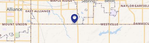
520 Un Ave Alliance, OH 44601-2929
Property profile & analytics
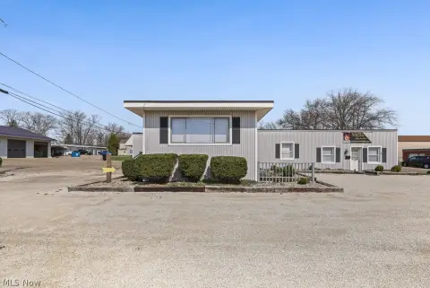
520 Un Ave Alliance, OH 44601-2929
- Commercial real estate
- 442 SF
- 0.33 lot acres
Property ID
US66-0467657
The Realmo ID is a unique identifier assigned to every property, incorporating country codes and precise geo-coordinates for 300x300-foot land blocks. It enables standardized data collection and seamless integration of disparate sources such as ownership, tax, title data and physical specifications. By aggregating current and historical records, the Realmo ID powers advanced analytics and delivers deep, verifiable insights for real estate professionals.
Location Intelligence
Current Use by Public Records
- Commercial real estate
Property Details for 520 Un Ave
- Year built
- 1967
- Construction
- CONCRETE
- Lot size
- 0.33 lot acres
- Property size
- 442 SF
- Property type
- Commercial real estate
- APN
- 01-02303
- APU
- 102303
Description
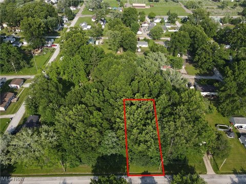
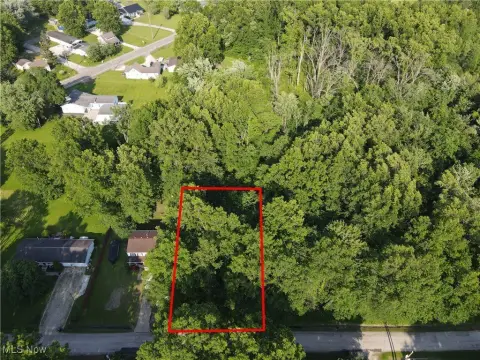
This 0.33-acre (14,375 sq ft) commercial land parcel in Alliance, Ohio, presents a unique investment opportunity. Located at the hard corner intersection of South Union Avenue and Oxford Street, this B-2 zoned property boasts 120 feet of frontage and benefits from a traffic light. The site enjoys high visibility due to its location on a major thoroughfare, with nearby businesses including Dollar General, Subway, and a recently opened Sanders Supermarket. The property's strategic position offers excellent access to Alliance High School (874 students), Alliance Community Hospital, and the University of Mount Union (2,200 undergraduates). South Union Avenue sees 12,000 ADT. Annual property taxes are approximately $718.75 (based on $0.05 per sq ft). All utilities are available. A $2500 per month land lease is available, or a build-to-suit option can be explored. This prime location offers significant potential for various commercial developments. Contact the owner for further details.
Value Estimations
based on Realmo’s proprietary methodology
-
AI approach
-
CAP approach
-
Comparable approach
-
Alternative Use
Get a detailed, property-specific estimation — fast and free
Location Insight
- Map
- Local Demand
- City
- Alliance
- County
- Stark
- State
- Ohio
- Longitude
- -81.1055
- Latitude
- 40.9172
- CBSA code
- 15940
- CBSA name
- CANTON-MASSILLON, OH METROPOLITAN STATISTICAL AREA
Property Tax & Assessments
Tax date
Tax Amount
Assessed Land Value
Assessed Improvement Value
Total Assessed Value
Applied Tax Rate
Land Market Value
Improvement Market Value
Total Market Value
2023
$696
$11,130
$2,000
$13,130
-
$31,800
$5,700
$37,500