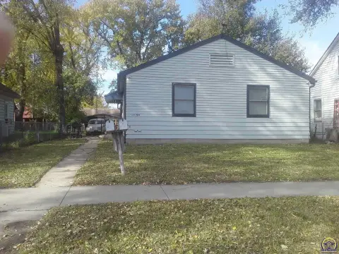
502 21St St Topeka, KS 66607
Property profile & analytics
502 21St St Topeka, KS 66607
- Commercial real estate
Property ID
US33-0799458
The Realmo ID is a unique identifier assigned to every property, incorporating country codes and precise geo-coordinates for 300x300-foot land blocks. It enables standardized data collection and seamless integration of disparate sources such as ownership, tax, title data and physical specifications. By aggregating current and historical records, the Realmo ID powers advanced analytics and delivers deep, verifiable insights for real estate professionals.
Location Intelligence
Current Use by Public Records
- Commercial real estate
Property Details for 502 21St St
- Property type
- Commercial real estate
- APN
- 089-133-06-0-40-12-013.00-0; 089-133-06-0-40-12-004.02-0; 089-133-06-0-40-12-013.00-0; 089-133-06-0-40-12-010.00-0; 089-133-06-0-40-12-009.00-0
Description
This exceptional commercial and residential land parcel, located at 502 SE 21st St, Topeka, Kansas 66607, presents a unique investment opportunity. The property, identified by APN numbers 089-133-06-0-40-12-013.00-0; 089-133-06-0-40-12-004.02-0; 089-133-06-0-40-12-013.00-0; 089-133-06-0-40-12-010.00-0; and 089-133-06-0-40-12-009.00-0, boasts a substantial lot size ranging from 5,500 to 62,291 square feet. Situated on the NW corner of 21st and SE Adams in Shawnee County, this land is zoned M-1 M2, allowing for diverse development possibilities. The legal description reads: Heery's 2nd Addition , Lot 208 + , Lt 208, Thru 216 Even Daf Beg Nw Co R Lt 208, E 105(S), S 70(S), Swly 4 0(S), W 75, N 100(S) to Pob Section 06 Township 12 Range 16. Offered at $288,000, this property is being sold by owner and presents a compelling chance to acquire a significant land holding in a desirable Topeka location. The property's versatility makes it suitable for a range of commercial and residential projects, capitalizing on its strategic position and substantial size.
Value Estimations
based on Realmo’s proprietary methodology
-
AI approach
-
CAP approach
-
Comparable approach
-
Alternative Use
Get a detailed, property-specific estimation — fast and free
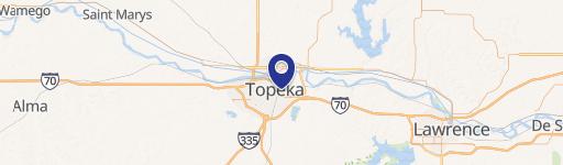
Location Insight
- Map
- Local Demand
- City
- Topeka
- County
- Shawnee
- State
- Kansas
- Longitude
- -95.670920601367
- Latitude
- 39.02973790481