
50 Main St, Oxford, MA 01540
 For Sale
1 / 3
For Sale
1 / 3
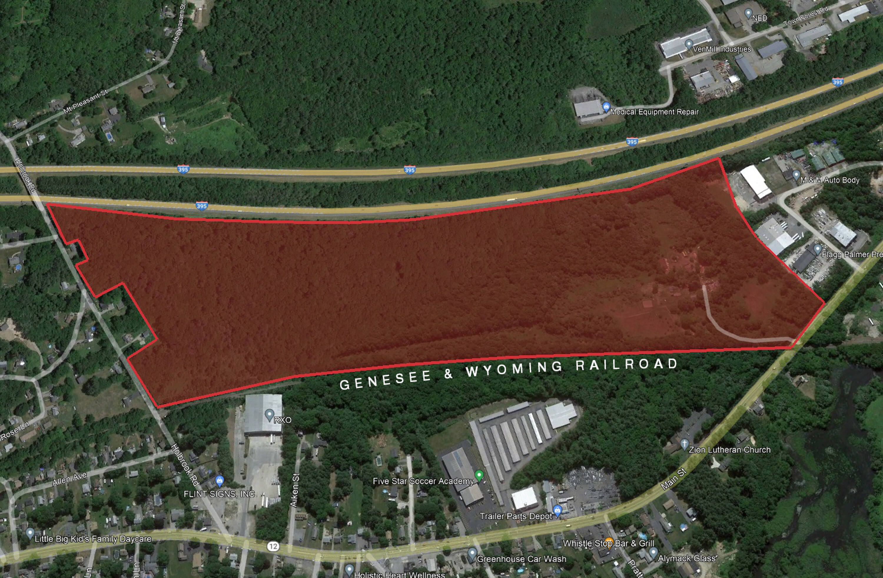
Approximately 76 acres of industrially zoned land with roughly 3,500 ft of rail frontage. The area closest to the rail line at the top right corner has additional land that is shown as wetlands. The 200k sf footprint of the building shown on the conceptual plan is just one possibility for this parcel and other layouts more favorable to multiple tenants are in play. The owner would like to hold back roughly 3 acres of the land for personal use making the saleable acreage roughly 73 acres. The property is situated in between Route 12 and Interstate 395 in Oxford, MA with access coming off of Route 12. The distance to the closest highway on ramp is just about a 1/2 mile to Interstate 395 and roughly 5 miles south for access to the Massachusetts Turnpike (i-90) ramp in Auburn.
Cap rate
Implied · in-place · derived from last sale + estimated NOIValue
AI, CAP & Alternative Use estimations · Realmo proprietary blendComparables
1 recent transactions · within 1.5 miProperty description
Physical attributes from public recordsZoning & alternative use
No recorded transactions found for this property.
Costs & Benchmarks
Operating expenses, capex projections, utility benchmarks, and submarket comparables — all in one view.
Risks
Flood, climate, environmental, title, and tenant-concentration risk — surfaced with mitigations and source citations.


