Property profile & analytics
4513 Snapfinger Woods Dr Decatur, GA 30035-4118
- Commercial land
- 2,100 SF
- 7.04 lot acres
OFF-MARKET
Value Estimations
Cap Rate Potential
Location Intelligence
Property ID
US22-2013082
The Realmo ID is a unique identifier assigned to every property, incorporating country codes and precise geo-coordinates for 300x300-foot land blocks. It enables standardized data collection and seamless integration of disparate sources such as ownership, tax, title data and physical specifications. By aggregating current and historical records, the Realmo ID powers advanced analytics and delivers deep, verifiable insights for real estate professionals.
Current Use by Public Records
- Commercial land
Property Details for 4513 Snapfinger Woods Dr
- Year built
- 1971
- Lot size
- 7.04 lot acres
- Property size
- 2,100 SF
- Zone code
- X
- Property type
- Commercial land
- APN
- 15 128 01 001
- APU
- 1512801001
Description
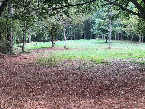
This exceptional 7.59-acre development site in Decatur, Georgia, presents a prime opportunity for multifamily and townhome construction. Located in DeKalb County, with APN 15-128-01-001, this property is zoned RSM and situated in the I-20 Corridor Overlay District, allowing for mixed-use developments with up to 40 dwelling units per acre, plus a 25% density bonus. Preliminary plans indicate the potential for over 55 townhome units and 280 multifamily apartment units. The site boasts a gently sloping topography and is conveniently located less than two miles west of the I-20 and I-285 interchange, offering excellent access and visibility. Its proximity to the Wesley Chapel Transit Oriented District (TOD) and a planned MARTA station enhances its appeal for transit-oriented development. Significant economic incentives are available through Qualified Census Tract (QCT) and Livable Center Initiative (LCI) designations. Water and sewer credits are also available, with all other utilities accessible at the road. This property is part of a larger assemblage but is available for purchase independently. The site's strategic location and zoning regulations make it an ideal investment for developers seeking high-density residential projects. This is a rare opportunity to capitalize on the growing demand for housing in this thriving area of DeKalb County. The address is 4513 Snapfinger Woods Dr, Decatur, GA 30035.
Value Estimations
based on Realmo’s proprietary methodology
-
AI approach
-
CAP approach
-
Comparable approach
-
Alternative Use
Get a detailed, property-specific valuation — fast and free
Location Insight
- Map
- Local Demand
- City
- Decatur
- County
- Dekalb
- State
- Georgia
- Longitude
- -84.2026
- Latitude
- 33.7079
- CBSA code
- 12060
- CBSA name
- ATLANTA-SANDY SPRINGS-MARIETTA, GA METROPOLITAN STATISTICAL AREA
Property Tax & Assessments
Tax date
Tax Amount
Assessed Land Value
Assessed Improvement Value
Total Assessed Value
Applied Tax Rate
Land Market Value
Improvement Market Value
Total Market Value
2024
$2,183
$23,160
$0.00
$23,160
-
$57,900
$0.00
$57,900