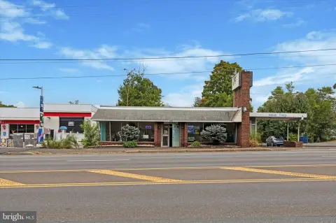
450 Easton Rd Horsham, PA 19044-2558
Property profile & analytics
450 Easton Rd, Horsham, PA 19044-2558
- Commercial land
- 2,284 SF
- 1.10 lot acres
Property ID
US73-1873972
The Realmo ID is a unique identifier assigned to every property, incorporating country codes and precise geo-coordinates for 300x300-foot land blocks. It enables standardized data collection and seamless integration of disparate sources such as ownership, tax, title data and physical specifications. By aggregating current and historical records, the Realmo ID powers advanced analytics and delivers deep, verifiable insights for real estate professionals.
Location Intelligence
Current Use by Public Records
- Commercial land
Property Details for 450 Easton Rd
- Year built
- 1940
- Lot size
- 1.10 lot acres
- Zone code
- GC2
- Property type
- Commercial land
- APN
- 36-00-03805-00-2
- APU
- 360003805002
Sales History
| Date | Price | Buyer | Seller | Deed Type | Mortgage |
|---|---|---|---|---|---|
| Nov 2, 2016 | — | Mb611 Properties LLC | Rueger,charles F SR & Mary F | Grant Deed | — |
| Sep 19, 2016 | $585,000 | Mb611 Properties LLC | Rueger,charles F SR & Mary F | Grant Deed | — |
| May 4, 2015 | — | Charles F Rueger SR. | Rueger Charles F SR & Mary F | Quit Claim Deed · related | — |
| Jun 8, 2012 | $4,720 | Charles F Rueger SR. | Sheriff Of Montgomery County | Trustees Deed · related | — |
| Jul 21, 2004 | $620,000 | 440 Easton Rd Prop LLC | Rueger,mary F | Grant Deed | — |
Value Estimations
based on Realmo’s proprietary methodology
-
AI approach
-
CAP approach
-
Comparable approach
-
Alternative Use
Get a detailed, property-specific estimation — fast and free
Location Insight
- Map
- Local Demand
- City
- Horsham
- County
- Montgomery
- State
- Pennsylvania
- Longitude
- -75.1305
- Latitude
- 40.1811
- CBSA code
- 37980
- CBSA name
- PHILADELPHIA-CAMDEN-WILMINGTON, PA-NJ-DE-MD METROPOLITAN STATISTICAL AREA
Property Tax & Assessments
Tax date
Tax Amount
Assessed Land Value
Assessed Improvement Value
Total Assessed Value
Applied Tax Rate
Land Market Value
Improvement Market Value
Total Market Value
2023
$7,579
$0.00
$0.00
$192,830
-
$0.00
$0.00
$192,830