Property profile & analytics
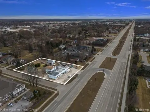
41453 Mound Rd Sterling Heights, MI 48314-4252
- Commercial land
- 6.19 lot acres
OFF-MARKET
Value Estimations
Cap Rate Potential
Location Intelligence
Property ID
US43-1560997
The Realmo ID is a unique identifier assigned to every property, incorporating country codes and precise geo-coordinates for 300x300-foot land blocks. It enables standardized data collection and seamless integration of disparate sources such as ownership, tax, title data and physical specifications. By aggregating current and historical records, the Realmo ID powers advanced analytics and delivers deep, verifiable insights for real estate professionals.
Current Use by Public Records
- Commercial land
Property Details for 41453 Mound Rd
- Lot size
- 6.19 lot acres
- Zone code
- TRO
- Property type
- Commercial land
- APN
- 10-10-08-476-011
- APU
- 101008476011
Description
This exceptional commercial land offering in Sterling Heights, Michigan presents a unique opportunity for development. Located at 41453 Mound Rd, in Macomb County, zip code 48314, this property currently consists of a single parcel slated for division into two approximately 3-acre parcels. The division will be based on a natural creek that bisects the land
Value Estimations
based on Realmo’s proprietary methodology
-
AI approach
-
CAP approach
-
Comparable approach
-
Alternative Use
Get a detailed, property-specific valuation — fast and free
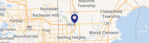
Location Insight
- Map
- Local Demand
- City
- Sterling Heights
- County
- Macomb
- State
- Michigan
- Longitude
- -83.0516
- Latitude
- 42.598
- CBSA code
- 19820
- CBSA name
- DETROIT-WARREN-LIVONIA, MI METROPOLITAN STATISTICAL AREA
Property Tax & Assessments
Tax date
Tax Amount
Assessed Land Value
Assessed Improvement Value
Total Assessed Value
Applied Tax Rate
Land Market Value
Improvement Market Value
Total Market Value
2022
$5,571
$0.00
$0.00
$101,200
-
$0.00
$0.00
$202,400