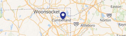
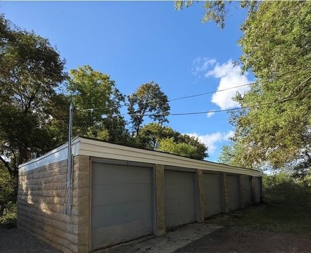
365 Riv Rd Lincoln, RI 02865-1530
Property profile & analytics
365 Riv Rd, Lincoln, RI 02865-1530
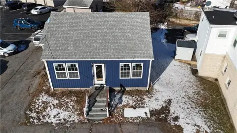
- Specialty properties
- 7,714 SF
- 0.73 lot acres
Property ID
US76-0306586
The Realmo ID is a unique identifier assigned to every property, incorporating country codes and precise geo-coordinates for 300x300-foot land blocks. It enables standardized data collection and seamless integration of disparate sources such as ownership, tax, title data and physical specifications. By aggregating current and historical records, the Realmo ID powers advanced analytics and delivers deep, verifiable insights for real estate professionals.
Location Intelligence
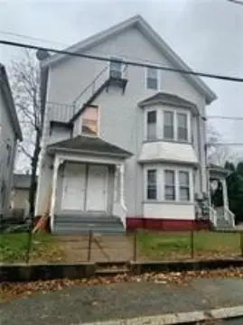
Current Use by Public Records
- The Spurwink School / Special Education Facility
Property Details for 365 Riv Rd
- Year built
- 1958
- Construction
- CONCRETE
- Lot size
- 0.73 lot acres
- Zone code
- RL9
- Property type
- Specialty properties
- APN
- LINC M:13 L:017.0 U:
- APU
- LINCM13L0170U
Sales History
| Date | Price | Buyer | Seller | Deed Type | Mortgage |
|---|---|---|---|---|---|
| Sep 17, 2024 | — | Spurwink Properties INC | — | Deed · related | $250k · Harborone Bank |
Value Estimations
based on Realmo’s proprietary methodology
-
Comparable approach
- Method
- Estimation
- AI Estimate
- $932,000
Market price range: $341k - $1.20M -
Alternative Use
- Use
- Estimation
- CLUBS, LODGES, PROFESSIONAL ASSOCIATIONS
- $1,400,000 Current use
- OFFICE BUILDING
- $1,475,000 Change: +5% Conversion: Difficult
Get a detailed, property-specific estimation — fast and free
Location Insight
- Map
- Local Demand
- City
- Lincoln
- County
- Providence
- State
- Rhode Island
- Longitude
- -71.4156
- Latitude
- 41.9131
- CBSA code
- 39300
- CBSA name
- PROVIDENCE-NEW BEDFORD-FALL RIVER, RI-MA METROPOLITAN STATISTICAL AREA
Property Tax & Assessments
Tax date
Tax Amount
Assessed Land Value
Assessed Improvement Value
Total Assessed Value
Applied Tax Rate
Land Market Value
Improvement Market Value
Total Market Value
2024
$0.00
$178,900
$1,030,600
$1,209,500
-
$0.00
$0.00
$0.00