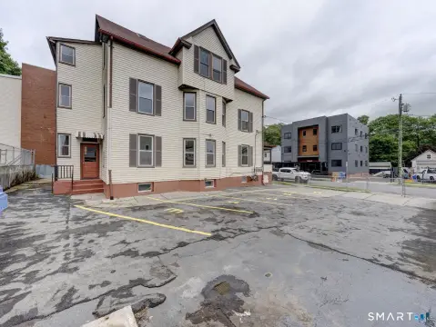
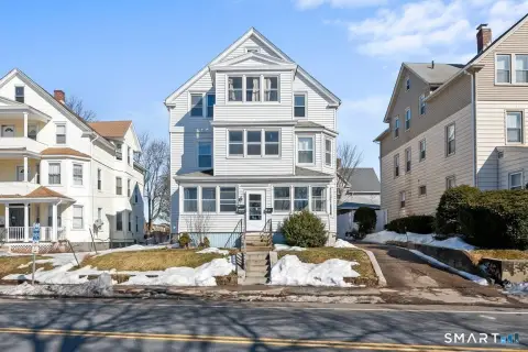
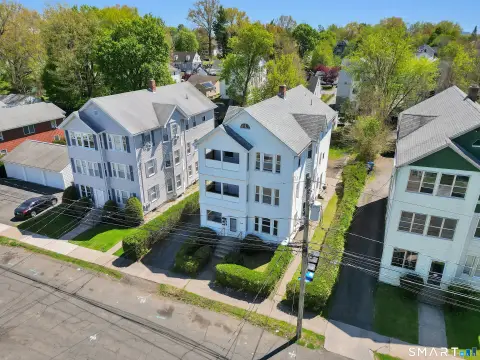
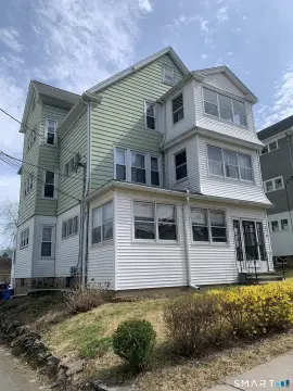
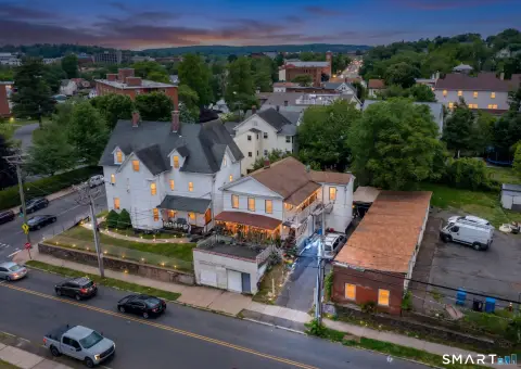
362 Chestnut St New Britain, CT 06051-2349
Property profile & analytics
362 Chestnut St, New Britain, CT 06051-2349
- Apartment buildings
- 5,383 SF
- 0.13 lot acres
Property ID
US15-0507908
The Realmo ID is a unique identifier assigned to every property, incorporating country codes and precise geo-coordinates for 300x300-foot land blocks. It enables standardized data collection and seamless integration of disparate sources such as ownership, tax, title data and physical specifications. By aggregating current and historical records, the Realmo ID powers advanced analytics and delivers deep, verifiable insights for real estate professionals.
Location Intelligence
Current Use by Public Records
- Lenny's Grocery II / Grocery & Convenience Store / Food Market
Property Details for 362 Chestnut St
- Year built
- 1900
- Lot size
- 0.13 lot acres
- Zone code
- T
- Property type
- Apartment buildings
- APN
- NBRI M:B8B B:80
- APU
- NBRIMB8BB80
Sales History
| Date | Price | Buyer | Seller | Deed Type | Mortgage |
|---|---|---|---|---|---|
| Apr 20, 2012 | $109,900 | Sarajevo 2000 | Bayview Loan Svcng LLC | Warranty Deed | — |
| Oct 6, 2011 | — | Bayview Loan Svcng LLC | Cohen,aaron | One Of Committee, Strict Foreclosure, Sheriff, Or Redemption Deeds · related | — |
| Dec 22, 2006 | $1 | 362 Chestnut Street LLC | Cohen,aaron | Grant Deed · related | — |
| Dec 18, 2006 | $1 | Aaron Cohen | 362 Chestnut Street LLC | Grant Deed · related | — |
| Oct 7, 2005 | — | 362 Chestnut Street LLC | — | Deed Of Trust · related | $170k · Omeowners Finance Co |
| Dec 4, 2002 | — | Mathew E Tuttelman | — | Deed Of Trust · related | $23k · Paul Thibodeau |
| Mar 20, 2002 | $100,000 | Paul Thibodeau | Semrow,robert A JR | Warranty Deed | $92k · Zenon Grzybowski |
Value Estimations
based on Realmo’s proprietary methodology
-
AI approach
-
CAP approach
-
Comparable approach
-
Alternative Use
Get a detailed, property-specific estimation — fast and free
Location Insight
- Map
- Local Demand
- City
- New Britain
- County
- Hartford
- State
- Connecticut
- Longitude
- -72.7689
- Latitude
- 41.667
- CBSA code
- 25540
- CBSA name
- HARTFORD-WEST HARTFORD-EAST HARTFORD, CT METROPOLITAN STATISTICAL AREA
Property Tax & Assessments
Tax date
Tax Amount
Assessed Land Value
Assessed Improvement Value
Total Assessed Value
Applied Tax Rate
Land Market Value
Improvement Market Value
Total Market Value
2024
$11,035
$40,950
$237,790
$278,740
-
$0.00
$0.00
$0.00