Property profile & analytics
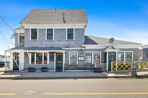
360 Woods Hole Rd Falmouth, MA 02543-1531
- Commercial real estate
- 63.88 lot acres
OFF-MARKET
Value Estimations
Cap Rate Potential
Location Intelligence
Property ID
US38-0998588
The Realmo ID is a unique identifier assigned to every property, incorporating country codes and precise geo-coordinates for 300x300-foot land blocks. It enables standardized data collection and seamless integration of disparate sources such as ownership, tax, title data and physical specifications. By aggregating current and historical records, the Realmo ID powers advanced analytics and delivers deep, verifiable insights for real estate professionals.
Current Use by Public Records
- Building 5 U.S. Geological Survey Crawford Lab / Sustainability Organization
- Building 27 McLean Laboratory / Laboratory
- Building 21 Fye Lab / High School
- Building 9 Clark Lab / Laboratory
Property Details for 360 Woods Hole Rd
- Lot size
- 63.88 lot acres
- Zone code
- PU
- Property type
- Commercial real estate
- APN
- FALM 50 S:04 P:000F L:000
- APU
- FALM50S04P000FL000
Value Estimations
based on Realmo’s proprietary methodology
-
AI approach
-
CAP approach
-
Comparable approach
-
Alternative Use
Get a detailed, property-specific valuation — fast and free
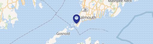
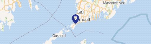
Location Insight
- Map
- Local Demand
- City
- Falmouth
- County
- Barnstable
- State
- Massachusetts
- Longitude
- -70.6501
- Latitude
- 41.5333
- CBSA code
- 12700
- CBSA name
- BARNSTABLE TOWN, MA METROPOLITAN STATISTICAL AREA
Property Tax & Assessments
Tax date
Tax Amount
Assessed Land Value
Assessed Improvement Value
Total Assessed Value
Applied Tax Rate
Land Market Value
Improvement Market Value
Total Market Value
2024
$45,414
$7,231,500
$0.00
$7,231,500
-
$0.00
$0.00
$0.00