2948 Rte 29 Middle Grove, NY 12850-1342
Property profile & analytics
2948 Rte 29, Middle Grove, NY 12850-1342
- Distribution centers
- 10,168 SF
- 5.92 lot acres
Property ID
US63-4660664
The Realmo ID is a unique identifier assigned to every property, incorporating country codes and precise geo-coordinates for 300x300-foot land blocks. It enables standardized data collection and seamless integration of disparate sources such as ownership, tax, title data and physical specifications. By aggregating current and historical records, the Realmo ID powers advanced analytics and delivers deep, verifiable insights for real estate professionals.
Location Intelligence
Current Use by Public Records
- Distribution centers
Property Details for 2948 Rte 29
- Year built
- 1988
- Lot size
- 5.92 lot acres
- Zone code
- AC
- Property type
- Distribution centers
- APN
- 413289 174.-1-24.1
- APU
- 4132891741241
Sales History
| Date | Price | Buyer | Seller | Deed Type | Mortgage |
|---|---|---|---|---|---|
| Jan 30, 2020 | — | Ryans Garage INC | — | Deed · related | $265k · Bank Of America |
| Jan 6, 2020 | $365,000 | Ryans Garage INC | Sparks F Russell | Warranty Deed | — |
| — | — | Ryans Garage INC | — | Deed Of Trust · related | $265k · Bank Of America |
Value Estimations
based on Realmo’s proprietary methodology
-
Comparable approach
- Method
- Estimation
- Statistic Estimate
- $651,000
- AI Estimate
- $379,000
Market price range: $652k - $1.35MMarket price range: $220k - $825k -
Alternative Use
- Use
- Estimation
- WAREHOUSE, STORAGE
- $905,000 Current use
Get a detailed, property-specific estimation — fast and free
Location Insight
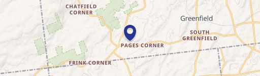
- Map
- Local Demand
- City
- Middle Grove
- County
- Saratoga
- State
- New York
- Longitude
- -73.9735
- Latitude
- 43.0719
- CBSA code
- 10580
- CBSA name
- ALBANY-SCHENECTADY-TROY, NY METROPOLITAN STATISTICAL AREA
Property Tax & Assessments
Tax date
Tax Amount
Assessed Land Value
Assessed Improvement Value
Total Assessed Value
Applied Tax Rate
Land Market Value
Improvement Market Value
Total Market Value
0
$0.00
$30,900
$333,100
$364,000
-
$38,625
$416,375
$455,000