293 Maple St Orwell, OH 44076-9446
Property profile & analytics
293 Maple St, Orwell, OH 44076-9446
- Commercial real estate
- 10,800 SF
- 17.54 lot acres
Property ID
US66-1039721
The Realmo ID is a unique identifier assigned to every property, incorporating country codes and precise geo-coordinates for 300x300-foot land blocks. It enables standardized data collection and seamless integration of disparate sources such as ownership, tax, title data and physical specifications. By aggregating current and historical records, the Realmo ID powers advanced analytics and delivers deep, verifiable insights for real estate professionals.
Location Intelligence
Current Use by Public Records
- Commercial real estate
Property Details for 293 Maple St
- Year built
- 1975
- Lot size
- 17.54 lot acres
- Property type
- Commercial real estate
- APN
- 39-018-00-002-00
- APU
- 390180000200
Sales History
| Date | Price | Buyer | Seller | Deed Type | Mortgage |
|---|---|---|---|---|---|
| Aug 29, 2023 | $1,121,500 | Maple Apartments LLC | 293 South Maple LLC | Warranty Deed | $929k · Meadowlane Apartments Of Orwell INC |
| Jan 14, 2022 | $1,345,000 | 293 South Maple LLC | Meadowlane Apartments Of Orwell INC | Warranty Deed | $985k · Meadowlane Apartments Of Orwell INC |
| Jan 14, 2022 | — | Robert E Glause JR | Meadowlane Apartments Of Orwell LLC | Quit Claim Deed · related | — |
| Dec 20, 2010 | $200,000 | Meadowlane Apartments Of Orwell I | Glause Norma J Trust | Warranty Deed | — |
Value Estimations
based on Realmo’s proprietary methodology
-
AI approach
- Method
- Estimation
- Statistic approach
- $1,215,000
- ML approach
- $1,050,000
-
CAP approach
- CAP Return
- Estimation
- 6%
- $1,310,000
- 6.5%
- $1,210,000
- 7%
- $1,125,000
-
Alternative Use
- Use
- Estimation
- RESTAURANT
- $740,000
Get a detailed, property-specific estimation — fast and free
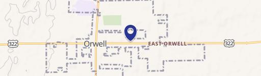
Location Insight
- Map
- Local Demand
- City
- Orwell
- County
- Ashtabula
- State
- Ohio
- Longitude
- -80.8612
- Latitude
- 41.5261
- CBSA code
- 11780
- CBSA name
- ASHTABULA, OH MICROPOLITAN STATISTICAL AREA
Property Tax & Assessments
Tax date
Tax Amount
Assessed Land Value
Assessed Improvement Value
Total Assessed Value
Applied Tax Rate
Land Market Value
Improvement Market Value
Total Market Value
2023
$1,207
$7,630
$11,060
$18,690
-
$21,800
$31,600
$53,400