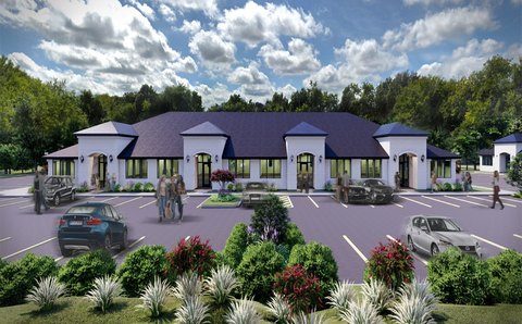
290 Miron Dr, Unit 4 Southlake, TX 76092-7858
Property profile & analytics
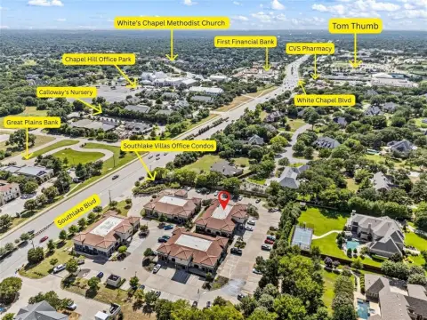
290 Miron Dr, Unit 4, Southlake, TX 76092-7858
- Office Spaces
- 5,535 SF
- 0.64 lot acres
Property ID
US82-5169396
The Realmo ID is a unique identifier assigned to every property, incorporating country codes and precise geo-coordinates for 300x300-foot land blocks. It enables standardized data collection and seamless integration of disparate sources such as ownership, tax, title data and physical specifications. By aggregating current and historical records, the Realmo ID powers advanced analytics and delivers deep, verifiable insights for real estate professionals.
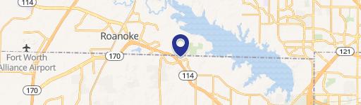
Location Intelligence
Current Use by Public Records
- Office Spaces
Property Details for 290 Miron Dr
- Year built
- 2007
- Lot size
- 0.64 lot acres
- Property type
- Office Spaces
- APN
- 26245C--4
- APU
- 26245C4
Sales History
| Date | Price | Buyer | Seller | Deed Type | Mortgage |
|---|---|---|---|---|---|
| Apr 5, 2016 | — | Heritage Partners III LLC | Miron Grove LLC | Grant Deed | $2.2M · Alliant Cu |
| Feb 15, 2013 | — | Miron Grove LLC | — | Trustees Deed · related | $175k · Frost Bank |
| Jun 21, 2010 | — | Miron Grove LLC | Rcc Miron Office Ltd | Quit Claim Deed | $1.8M · Frost National Bank |
Value Estimations
based on Realmo’s proprietary methodology
-
AI approach
-
CAP approach
-
Comparable approach
-
Alternative Use
Get a detailed, property-specific estimation — fast and free
Location Insight
- Map
- Local Demand
- City
- Southlake
- County
- Tarrant
- State
- Texas
- Longitude
- -97.1267
- Latitude
- 32.939
- CBSA code
- 19100
- CBSA name
- DALLAS-FORT WORTH-ARLINGTON, TX METROPOLITAN STATISTICAL AREA
Property Tax & Assessments
Tax date
Tax Amount
Assessed Land Value
Assessed Improvement Value
Total Assessed Value
Applied Tax Rate
Land Market Value
Improvement Market Value
Total Market Value
2023
$30,265
$203,385
$1,540,140
$1,743,525
-
$203,385
$1,540,140
$1,743,525