
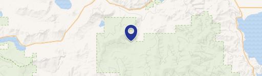
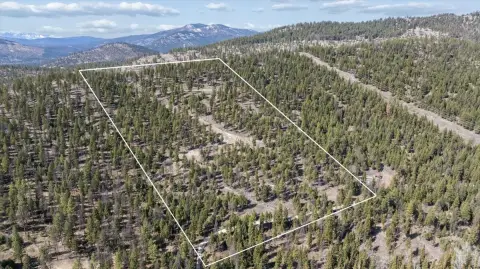
280 Smoke Ridge Rd, Kila, MT 59920
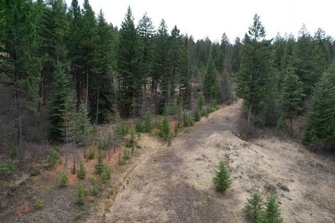
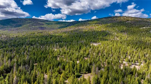
This exceptional 5-acre (217,800 sq ft) residential lot presents a unique opportunity to build your dream home in the desirable Kila, Montana area. Nestled amidst towering ponderosa pines, this secluded parcel offers breathtaking views while maintaining convenient proximity to Kalispell, just a 15-minute drive away. The property boasts multiple potential building sites, allowing for flexible home placement to maximize the stunning natural surroundings. Electricity is readily available, simplifying the construction process. While a road maintenance agreement is understood to be in place among the residents of Smoke Ridge Road, it's important to note that this agreement is not currently documented in writing. Owners contribute $250 annually for road maintenance down to Hoffman Draw, where county maintenance begins. There are no active homeowner's associations or associated dues. The address is 280 Smoke Ridge Road, Kila, MT 59920. This property offers the perfect blend of peaceful seclusion and convenient access to amenities, making it an ideal location for building a custom home in Northwest Montana. The asking price for this remarkable property is $325,000.
Cap rate
Implied · in-place · derived from last sale + estimated NOIValue
AI, CAP & Alternative Use estimations · Realmo proprietary blendComparables
6 recent transactions · within 1.5 miComparable in this City


Similar Nearby for Sale
Property description
Physical attributes from public recordsZoning & alternative use
No recorded transactions found for this property.
Costs & Benchmarks
Operating expenses, capex projections, utility benchmarks, and submarket comparables — all in one view.
Risks
Flood, climate, environmental, title, and tenant-concentration risk — surfaced with mitigations and source citations.


