2630 National Dr Garland, TX 75041-2331
Property profile & analytics
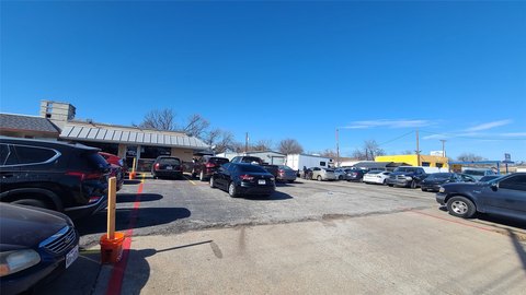
2630 National Dr, Garland, TX 75041-2331
- Showrooms
- 9,030 SF
- 0.46 lot acres
Property ID
US82-2751544
The Realmo ID is a unique identifier assigned to every property, incorporating country codes and precise geo-coordinates for 300x300-foot land blocks. It enables standardized data collection and seamless integration of disparate sources such as ownership, tax, title data and physical specifications. By aggregating current and historical records, the Realmo ID powers advanced analytics and delivers deep, verifiable insights for real estate professionals.
Location Intelligence
Current Use by Public Records
- WaveWare Technologies, Inc. / Factory / Production Facility
Property Details for 2630 National Dr
- Year built
- 1971
- Construction
- TILT-UP CONCRETE
- Lot size
- 0.46 lot acres
- Zone code
- Z144
- Property type
- Showrooms
- APN
- 26296500040050000
- APU
- 26296500040050000
Sales History
| Date | Price | Buyer | Seller | Deed Type | Mortgage |
|---|---|---|---|---|---|
| Feb 25, 2011 | — | Culleoka Farm LLC | Knight,kin D & Sandra S | Grant Deed | $268k · Prosperity Bank |
| Aug 5, 1997 | — | Money Store INC | Jones,jay W | Grant Deed | $243k · Money Store INC |
| — | — | Sandra S Knight | — | Deed Of Trust · related | $255k · Cnl Commercial Finance INC |
Value Estimations
based on Realmo’s proprietary methodology
-
AI approach
-
CAP approach
-
Comparable approach
-
Alternative Use
Get a detailed, property-specific estimation — fast and free
Location Insight
- Map
- Local Demand
- City
- Garland
- County
- Dallas
- State
- Texas
- Longitude
- -96.6716
- Latitude
- 32.8843
- CBSA code
- 19100
- CBSA name
- DALLAS-FORT WORTH-ARLINGTON, TX METROPOLITAN STATISTICAL AREA
Property Tax & Assessments
Tax date
Tax Amount
Assessed Land Value
Assessed Improvement Value
Total Assessed Value
Applied Tax Rate
Land Market Value
Improvement Market Value
Total Market Value
2023
$11,677
$60,000
$450,330
$510,330
-
$60,000
$450,330
$510,330