223 Hwy 72 Burnsville, MS 38833-9316
Property profile & analytics
223 Hwy 72, Burnsville, MS 38833-9316
- Retail space
- 6,090 SF
- 2.80 lot acres
Property ID
US50-1621211
The Realmo ID is a unique identifier assigned to every property, incorporating country codes and precise geo-coordinates for 300x300-foot land blocks. It enables standardized data collection and seamless integration of disparate sources such as ownership, tax, title data and physical specifications. By aggregating current and historical records, the Realmo ID powers advanced analytics and delivers deep, verifiable insights for real estate professionals.
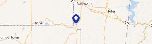
Location Intelligence
Current Use by Public Records
- Retail space
Property Details for 223 Hwy 72
- Year built
- 1961
- Construction
- WOOD
- Lot size
- 2.80 lot acres
- Property type
- Retail space
- APN
- 0301-15-02-005.04
- APU
- 301150200504
Sales History
| Date | Price | Buyer | Seller | Deed Type | Mortgage |
|---|---|---|---|---|---|
| Mar 19, 2025 | — | Four Subs LLC | Vrajlal Parmanand Kariya | Quitclaim Deed · related | — |
| Jul 12, 2024 | — | Vrajlal Parmanand Kariya | Symbiotic Partners LLC | Quitclaim Deed · related | — |
| Jun 12, 2024 | — | Symbiotic Partners LLC | L And T LLC | Deed · related | — |
| Oct 29, 2021 | — | Four Subs LLC | L And T Lcc | Warranty Deed | — |
| Jun 2, 2021 | — | Four Subs LLC | — | Deed · related | $51k · Farmers & Merchants Bank |
| Jul 28, 2020 | — | Four Subs LLC | — | Deed · related | $169k · Farmers & Merchants Bank |
| Nov 9, 2011 | — | L&t, LLC | Image Wholesale, INC | Warranty Deed | — |
Value Estimations
based on Realmo’s proprietary methodology
-
AI approach
-
CAP approach
-
Comparable approach
-
Alternative Use
Get a detailed, property-specific estimation — fast and free
Location Insight
- Map
- Local Demand
- City
- Burnsville
- County
- Tishomingo
- State
- Mississippi
- Longitude
- -88.328
- Latitude
- 34.8442
Property Tax & Assessments
Tax date
Tax Amount
Assessed Land Value
Assessed Improvement Value
Total Assessed Value
Applied Tax Rate
Land Market Value
Improvement Market Value
Total Market Value
0
$0.00
$0.00
$0.00
$15,618
-
$22,960
$81,160
$104,120