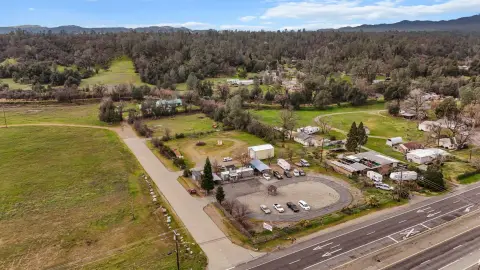
1981 State Hwy 273 Anderson, CA 96007-4265
Property profile & analytics
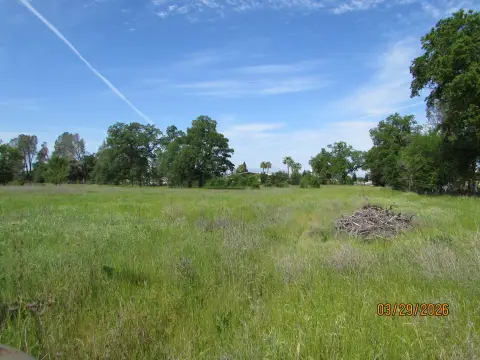
1981 State Hwy 273, Anderson, CA 96007-4265
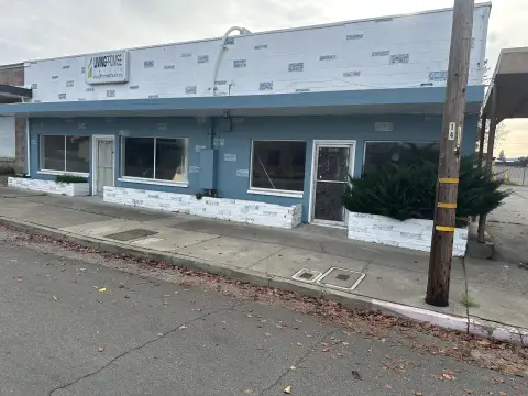
- Retail space
- 14.60 lot acres
Property ID
US09-5251905
The Realmo ID is a unique identifier assigned to every property, incorporating country codes and precise geo-coordinates for 300x300-foot land blocks. It enables standardized data collection and seamless integration of disparate sources such as ownership, tax, title data and physical specifications. By aggregating current and historical records, the Realmo ID powers advanced analytics and delivers deep, verifiable insights for real estate professionals.
Location Intelligence
Current Use by Public Records
- Retail space
Property Details for 1981 State Hwy 273
- Year built
- 1991
- Lot size
- 14.60 lot acres
- Property type
- Retail space
- APN
- 202-500-046-000
- APU
- 202500046000
Sales History
| Date | Price | Buyer | Seller | Deed Type | Mortgage |
|---|---|---|---|---|---|
| Apr 20, 2026 | — | Patterson Gary | Elizabeth Patterson | Grant Deed · related | — |
| Apr 12, 2024 | — | Paradise 3941 LLC | Gaylon C Petterson | Grant Deed | — |
| Oct 10, 2022 | — | Lynette F Branagh | Lynette F Branagh | Correction Deed · related | — |
| Sep 6, 2022 | — | Richard A Cordes | Richard A Cordes | Intrafamily Transfer · related | — |
| Jul 5, 2022 | $1,159,000 | Bobby Allen Richardson | Maronda Homes LLC | Grant Deed | — |
| Dec 22, 2017 | — | Branagh Family 2000 Trust | 2000 Branagh F Trust | Quit Claim Deed · related | $12.5M · Bank Of West |
| Feb 1, 2017 | — | Gary L Patterson | — | Deed · related | — |
| Dec 18, 2015 | — | Gary L Patterson | Klp Properties INC | Quit Claim Deed · related | — |
| — | — | Richard A Cordes | — | Loan Modification · related | — |
| — | — | Gary L Patterson | — | Loan Modification · related | — |
Value Estimations
based on Realmo’s proprietary methodology
-
AI approach
-
CAP approach
-
Comparable approach
-
Alternative Use
Get a detailed, property-specific estimation — fast and free
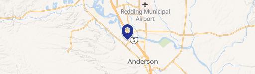
Location Insight
- Map
- Local Demand
- City
- Anderson
- County
- Shasta
- State
- California
- Longitude
- -122.288
- Latitude
- 40.4352
- CBSA code
- 39820
- CBSA name
- REDDING, CA METROPOLITAN STATISTICAL AREA
Property Tax & Assessments
Tax date
Tax Amount
Assessed Land Value
Assessed Improvement Value
Total Assessed Value
Applied Tax Rate
Land Market Value
Improvement Market Value
Total Market Value
2024
$151,555
$4,523,971
$7,250,468
$11,774,439
-
$0.00
$0.00
$0.00