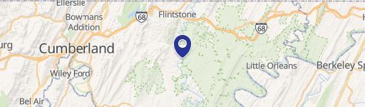
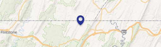
19707 Perrin NE Ln Flintstone, MD 21530-1163
Property profile & analytics
19707 Perrin NE Ln, Flintstone, MD 21530-1163
- Commercial real estate
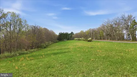
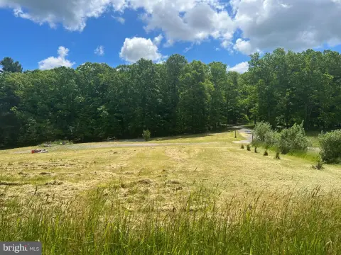
- 2,114 SF
- 5.65 lot acres
Property ID
US40-1122449
The Realmo ID is a unique identifier assigned to every property, incorporating country codes and precise geo-coordinates for 300x300-foot land blocks. It enables standardized data collection and seamless integration of disparate sources such as ownership, tax, title data and physical specifications. By aggregating current and historical records, the Realmo ID powers advanced analytics and delivers deep, verifiable insights for real estate professionals.
Location Intelligence
Current Use by Public Records
- Mountainview Storage Sheds / General Contractor
- Mountainside Equipment & Repair / Auto Repair Shop
Property Details for 19707 Perrin NE Ln
- Year built
- 2005
- Lot size
- 5.65 lot acres
- Property type
- Commercial real estate
- APN
- 03-014770
- APU
- 3014770
Sales History
| Date | Price | Buyer | Seller | Deed Type | Mortgage |
|---|---|---|---|---|---|
| Jun 30, 2015 | $300,000 | Paul L Petre | Hege Lavern R & Phebe J | Grant Deed | — |
| Apr 12, 2006 | — | Lavern R Hege | Hege,lavern R | Quit Claim Deed · related | — |
| Dec 22, 2004 | $22,600 | Lavern R Hege | Martin,naomi | Grant Deed | — |
Value Estimations
based on Realmo’s proprietary methodology
-
AI approach
-
CAP approach
-
Comparable approach
-
Alternative Use
Get a detailed, property-specific estimation — fast and free
Location Insight
- Map
- Local Demand
- City
- Flintstone
- County
- Allegany
- State
- Maryland
- Longitude
- -78.6038
- Latitude
- 39.7156
- CBSA code
- 19060
- CBSA name
- CUMBERLAND, MD-WV METROPOLITAN STATISTICAL AREA
Property Tax & Assessments
Tax date
Tax Amount
Assessed Land Value
Assessed Improvement Value
Total Assessed Value
Applied Tax Rate
Land Market Value
Improvement Market Value
Total Market Value
2023
$3,172
$80,900
$210,900
$291,800
-
$80,900
$210,900
$291,800