
1920 Riverside Dr Austin, TX 78741-1342
Property profile & analytics
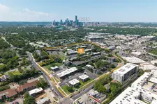
1920 Riverside Dr, Austin, TX 78741-1342
- Strip malls
- 9,872 SF
- 2.96 lot acres
Property ID
US82-9837976
The Realmo ID is a unique identifier assigned to every property, incorporating country codes and precise geo-coordinates for 300x300-foot land blocks. It enables standardized data collection and seamless integration of disparate sources such as ownership, tax, title data and physical specifications. By aggregating current and historical records, the Realmo ID powers advanced analytics and delivers deep, verifiable insights for real estate professionals.
Location Intelligence
Current Use by Public Records
- Pokeworks / Restaurant
- Pho Please / Restaurant
- MOD Pizza / Restaurant
- BLVD Dentistry & Orthodontics- Riverside / Dental Office
- Walgreens Photo / (Bike/Boat/Book/etc) Store
Property Details for 1920 Riverside Dr
- Year built
- 2015
- Lot size
- 2.96 lot acres
- Property type
- Strip malls
- Property subtype
- Shopping centers
- APN
- 304060103
- APU
- 304060103
Sales History
| Date | Price | Buyer | Seller | Deed Type | Mortgage |
|---|---|---|---|---|---|
| Jun 30, 2016 | — | Ss Retail Dev 2013 LP | — | Deed · related | $14.1M · Jp Morgan Chase Bk |
| — | — | Ss Retail Dev 2013 LP | — | Deed Of Trust · related | $14.1M · Jp Morgan Chase Bk |
Value Estimations
based on Realmo’s proprietary methodology
-
AI approach
-
CAP approach
-
Comparable approach
-
Alternative Use
Get a detailed, property-specific estimation — fast and free
Location Insight
- Map
- Local Demand
- City
- Austin
- County
- Travis
- State
- Texas
- Longitude
- -97.7279
- Latitude
- 30.2427
- CBSA code
- 12420
- CBSA name
- AUSTIN-ROUND ROCK, TX METROPOLITAN STATISTICAL AREA
Property Tax & Assessments
Tax date
Tax Amount
Assessed Land Value
Assessed Improvement Value
Total Assessed Value
Applied Tax Rate
Land Market Value
Improvement Market Value
Total Market Value
2022
$258,852
$6,449,058
$7,802,942
$14,252,000
-
$6,449,058
$7,802,942
$14,252,000
Comparable in this City


Similar Nearby for Sale


Similar Nearby for Lease


Property Visit Statistics
-
Visits by month26.1k
-
Visitors by month13.4k
-
Avg Time on site12 min


