153 Falmouth Hwy E Falmouth, MA 02536-6038
Property profile & analytics
153 Falmouth Hwy, E Falmouth, MA 02536-6038
- Investment properties
- 4,884 SF
- 0.64 lot acres
Property ID
US38-1123632
The Realmo ID is a unique identifier assigned to every property, incorporating country codes and precise geo-coordinates for 300x300-foot land blocks. It enables standardized data collection and seamless integration of disparate sources such as ownership, tax, title data and physical specifications. By aggregating current and historical records, the Realmo ID powers advanced analytics and delivers deep, verifiable insights for real estate professionals.
Location Intelligence
Current Use by Public Records
- Investment properties
Property Details for 153 Falmouth Hwy
- Year built
- 1930
- Construction
- FRAME
- Lot size
- 0.64 lot acres
- Zone code
- B2
- Property type
- Investment properties
- Property subtype
- Live-work space
- APN
- FALM 33 S:10 P:007 L:001C
- APU
- FALM33S10P007L001C
Sales History
| Date | Price | Buyer | Seller | Deed Type | Mortgage |
|---|---|---|---|---|---|
| May 2, 2017 | $650,000 | Jcd Family LLC | Roy S Clement | Quit Claim Deed · related | $325k · Cape Cod Five Cents Savings Bank |
Value Estimations
based on Realmo’s proprietary methodology
-
Comparable approach
- Method
- Estimation
- Statistic Estimate
- $954,000
- AI Estimate
- $492,000
Market price range: $787k - $2.21MMarket price range: $350k - $980k
Get a detailed, property-specific estimation — fast and free
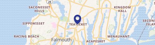
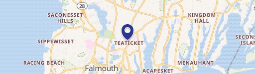
Location Insight
- Map
- Local Demand
- City
- E Falmouth
- County
- Barnstable
- State
- Massachusetts
- Longitude
- -70.5681
- Latitude
- 41.5783
- CBSA code
- 12700
- CBSA name
- BARNSTABLE TOWN, MA METROPOLITAN STATISTICAL AREA
Property Tax & Assessments
Tax date
Tax Amount
Assessed Land Value
Assessed Improvement Value
Total Assessed Value
Applied Tax Rate
Land Market Value
Improvement Market Value
Total Market Value
2024
$4,841
$424,300
$346,600
$770,900
-
$0.00
$0.00
$0.00