Property profile & analytics
1502 6th Ave Tacoma, WA 98405-3301
- Commercial real estate
- 1,117 SF
- 0.37 lot acres
OFF-MARKET
Last Sale
May 30, 2025
May 30, 2025
Value Estimations
Cap Rate Potential
Location Intelligence
Property ID
US90-1021234
The Realmo ID is a unique identifier assigned to every property, incorporating country codes and precise geo-coordinates for 300x300-foot land blocks. It enables standardized data collection and seamless integration of disparate sources such as ownership, tax, title data and physical specifications. By aggregating current and historical records, the Realmo ID powers advanced analytics and delivers deep, verifiable insights for real estate professionals.
Current Use by Public Records
- Security Lock, Safe, & Alarm Inc / Locksmith
Property Details for 1502 6th Ave
- Year built
- 1963
- Construction
- WOOD FRAME
- Lot size
- 0.37 lot acres
- Property size
- 1,117 SF
- Zone code
- C2
- Property type
- Commercial real estate
- APN
- 2006300010
- APU
- 2006300010
Description
This exceptional 0.37-acre commercial land parcel, located at 1502 6th Ave in Tacoma, Washington (APN 2006300010), presents a unique investment opportunity. Zoned C2 (General Community Commercial District), this property allows for a wide range of uses including office, retail, restaurant, drive-thru, gas station, self-storage, large-scale retail, and personal services. The lot size is 16,250 square feet, with a maximum permitted retail square footage of 45,000 square feet and a 45-foot height limit. No additional Floor Area Ratio (FAR) requirements exist. The asking price is $1,200,000, translating to $61.54 per square foot. This highly visible corner lot enjoys excellent daily traffic counts, estimated at 10,000 cars per day, and benefits from convenient access to major transportation arteries, including Highway 16 and I-5. Its strategic location places it within close proximity to Tacoma General Hospital, a vibrant retail district, local services, schools, residential areas, Ruston Way, Point Defiance, the Port of Tacoma, and the Point Defiance-Tahlequah Ferry dock. The site previously housed a gas station
Value Estimations
based on Realmo’s proprietary methodology
-
AI approach
-
CAP approach
-
Comparable approach
-
Alternative Use
Get a detailed, property-specific valuation — fast and free
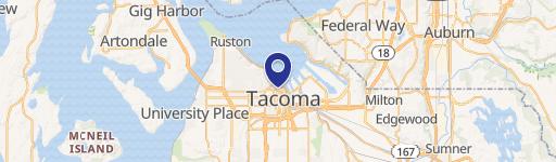
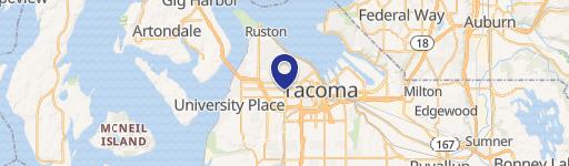
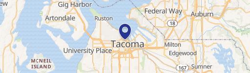
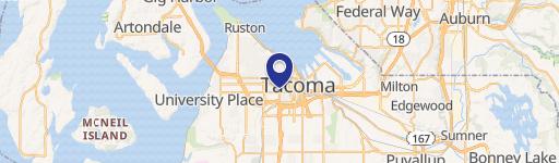
Location Insight
- Map
- Local Demand
- City
- Tacoma
- County
- Pierce
- State
- Washington
- Longitude
- -122.459
- Latitude
- 47.2562
- CBSA code
- 42660
- CBSA name
- SEATTLE-TACOMA-BELLEVUE, WA METROPOLITAN STATISTICAL AREA
Property Tax & Assessments
Tax date
Tax Amount
Assessed Land Value
Assessed Improvement Value
Total Assessed Value
Applied Tax Rate
Land Market Value
Improvement Market Value
Total Market Value
2024
$5,060
$454,600
$0.00
$454,600
-
$454,600
$0.00
$454,600