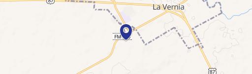
139 Industrial Dr La Vernia, TX 78121-5830
Property profile & analytics
139 Industrial Dr, La Vernia, TX 78121-5830
- Commercial real estate
- 1,400 SF
- 0.26 lot acres
Property ID
US82-4684974
The Realmo ID is a unique identifier assigned to every property, incorporating country codes and precise geo-coordinates for 300x300-foot land blocks. It enables standardized data collection and seamless integration of disparate sources such as ownership, tax, title data and physical specifications. By aggregating current and historical records, the Realmo ID powers advanced analytics and delivers deep, verifiable insights for real estate professionals.
Location Intelligence
Current Use by Public Records
- Commercial real estate
Property Details for 139 Industrial Dr
- Lot size
- 0.26 lot acres
- Property type
- Commercial real estate
- APN
- 3000-03000-12100
- APU
- 30000300012100
Sales History
| Date | Price | Buyer | Seller | Deed Type | Mortgage |
|---|---|---|---|---|---|
| Mar 4, 2020 | — | T One Interior Design LLC | Charles Jason Strickland | Venders Lien | $180k · Third Coast Bank Ssb |
Value Estimations
based on Realmo’s proprietary methodology
-
AI approach
-
CAP approach
-
Comparable approach
-
Alternative Use
Get a detailed, property-specific estimation — fast and free
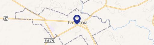
Location Insight
- Map
- Local Demand
- City
- La Vernia
- County
- Wilson
- State
- Texas
- Longitude
- -98.1215
- Latitude
- 29.3575
- CBSA code
- 41700
- CBSA name
- SAN ANTONIO, TX METROPOLITAN STATISTICAL AREA
Property Tax & Assessments
Tax date
Tax Amount
Assessed Land Value
Assessed Improvement Value
Total Assessed Value
Applied Tax Rate
Land Market Value
Improvement Market Value
Total Market Value
2023
$2,251
$38,000
$97,420
$135,420
-
$38,000
$97,420
$135,420