
13137 Wornall Rd, Kansas City, MO 64145
 For Sale
1 / 43
For Sale
1 / 43
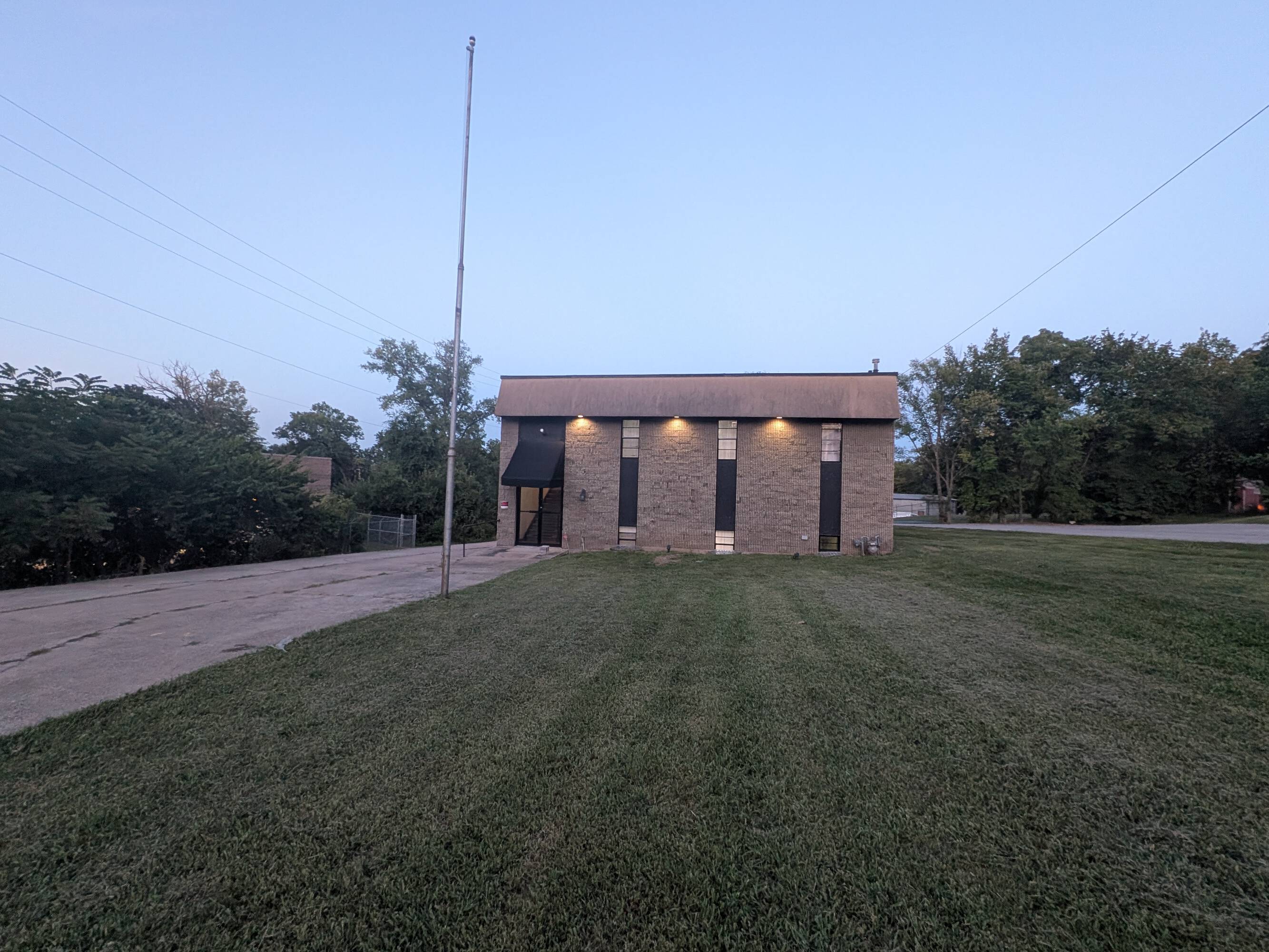
This exceptional investment opportunity presents a 4,800-square-foot flex space located at 13137 Wornall Road in Kansas City, Missouri. The property, situated on a 0.73-acre lot, boasts a rich history as a former VFW Hall, offering significant potential for adaptive reuse. Built in 1958 and renovated in 1986, the two-story building features a 9-foot ceiling height. The property's zoning allows for a variety of uses, designated as B4-2/R7.5, making it suitable for a range of commercial and residential applications. The ample lot size provides significant potential for expansion or additional development. The property is conveniently located in Jackson County, Missouri, with a zip code of 64145. The building currently offers 4,800 square feet of net rentable space, ideal for an owner-user seeking a versatile space. The property also benefits from prominent monument signage, enhancing visibility and branding opportunities. This property is located in an Opportunity Zone, offering potential tax advantages for qualified investors. The absence of loading docks presents an opportunity for creative space planning and utilization. This unique property offers a compelling blend of history, versatility, and location, making it an attractive investment prospect.
Cap rate
Implied · in-place · derived from last sale + estimated NOIValue
AI, CAP & Alternative Use estimations · Realmo proprietary blendComparables
6 recent transactions · within 1.5 miComparable in this City


Similar Nearby for Sale
Property description
Physical attributes from public recordsZoning & alternative use
No recorded transactions found for this property.
Costs & Benchmarks
Operating expenses, capex projections, utility benchmarks, and submarket comparables — all in one view.
Risks
Flood, climate, environmental, title, and tenant-concentration risk — surfaced with mitigations and source citations.


