
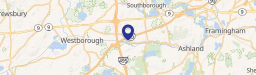
125 Flanders Rd, Westborough, MA 01581-1095
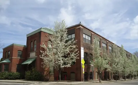
This exceptional industrial warehouse property, located at 125 Flanders Road in Westborough, Massachusetts, offers a range of flexible spaces ideal for various business needs. The single-story, Class B building, constructed in 1976, sits on a generous 6.25 acres of land and boasts 14 loading docks and 2 drive-in doors, ensuring efficient loading and unloading operations. Available spaces range from 5,000 square feet to 23,400 square feet, catering to businesses of varying sizes. The property features a substantial 50-space parking lot, providing ample parking for employees and visitors, exceeding a 0.65 parking ratio. The building offers a clear height of 16 to 18 feet, providing ample vertical space for storage and operations. Its high-visibility location presents excellent signage opportunities, enhancing brand awareness. The strategic location provides easy access to major transportation arteries, including the Massachusetts Turnpike (MA Pike), Route 9, and I-495, facilitating seamless logistics and distribution. The property is suitable for manufacturing, warehousing, research and development, and office uses. This is a prime opportunity to secure well-located industrial space in a thriving market. The property is zoned for industrial use. The zip code is 01581.
Cap rate
Implied · in-place · derived from last sale + estimated NOIValue
AI, CAP & Alternative Use estimations · Realmo proprietary blendProperty tax & assessments
Tax year 2024Comparables
6 recent transactions · within 1.5 miComparable in this City


Similar Nearby for Lease

Property description
Physical attributes from public recordsZoning & alternative use
IA · Westborough, MAWestborough. Always verify with local authorities before improvements.
No recorded transactions found for this property.
Costs & Benchmarks
Operating expenses, capex projections, utility benchmarks, and submarket comparables — all in one view.
Risks
Flood, climate, environmental, title, and tenant-concentration risk — surfaced with mitigations and source citations.


