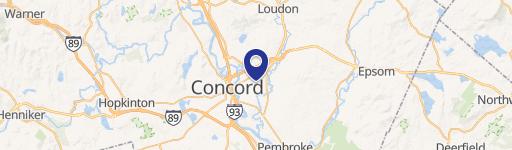
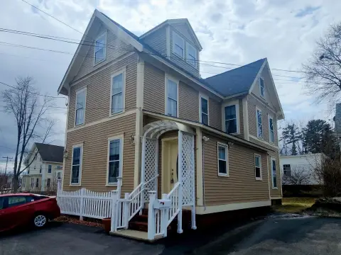
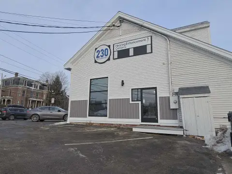
125 Airport Rd Concord, NH 03301-7300
Property profile & analytics
125 Airport Rd Concord, NH 03301-7300
- Office buildings
- 14,634 SF
- 3.00 lot acres
Property ID
US58-0254112
The Realmo ID is a unique identifier assigned to every property, incorporating country codes and precise geo-coordinates for 300x300-foot land blocks. It enables standardized data collection and seamless integration of disparate sources such as ownership, tax, title data and physical specifications. By aggregating current and historical records, the Realmo ID powers advanced analytics and delivers deep, verifiable insights for real estate professionals.
Location Intelligence
Current Use by Public Records
- Granite United Way / Charitable Organization / Social Service Agency
- New Hampshire Health Care Association / Association / Organization / Non-Profit Organization
- New England Environmental / Environmental Consultant
- RECNH / Hospital
- Foundation for Healthy Communities / Charitable Organization / Social Service Agency
Property Details for 125 Airport Rd
- Year built
- 1984
- Construction
- FRAME
- Lot size
- 3.00 lot acres
- Property size
- 14,634 SF
- Zone code
- IN
- Property type
- Office buildings
- APN
- CNCD M:752Z B:6
- APU
- CNCDM752ZB6
Value Estimations
based on Realmo’s proprietary methodology
-
Comparable approach
- Method
- Estimation
- Statistic Estimate
- $1,608,000
- AI Estimate
- $1,077,000
Market price range: $1.61M - $2.57MMarket price range: $735k - $2.00M -
Alternative Use
- Use
- Estimation
- OFFICE BUILDING
- $1,970,000 Current use
- COMMERCIAL (GENERAL)
- $2,240,000 Change: +14% Conversion: Easy
- RETAIL STORES
- $2,210,000 Change: +12% Conversion: Moderate
- INDUSTRIAL (GENERAL)
- $2,065,000 Change: +5% Conversion: Difficult
Get a detailed, property-specific estimation — fast and free
Location Insight
- Map
- Local Demand
- City
- Concord
- County
- Merrimack
- State
- New Hampshire
- Longitude
- -71.5054
- Latitude
- 43.1999
- CBSA code
- 18180
- CBSA name
- CONCORD, NH MICROPOLITAN STATISTICAL AREA
Property Tax & Assessments
Tax date
Tax Amount
Assessed Land Value
Assessed Improvement Value
Total Assessed Value
Applied Tax Rate
Land Market Value
Improvement Market Value
Total Market Value
2023
$39,293
$314,200
$1,148,700
$1,462,900
-
$0.00
$0.00
$0.00