Property profile & analytics
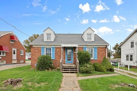
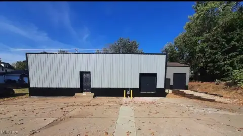
12155 Fisher NE Ave Alliance, OH 44601-1038
- Manufacturing properties
- 84,095 SF
- 9.48 lot acres
OFF-MARKET
Value Estimations
$4,470,000
Show details
Cap Rate Potential
Location Intelligence
Property ID
US66-2002695
The Realmo ID is a unique identifier assigned to every property, incorporating country codes and precise geo-coordinates for 300x300-foot land blocks. It enables standardized data collection and seamless integration of disparate sources such as ownership, tax, title data and physical specifications. By aggregating current and historical records, the Realmo ID powers advanced analytics and delivers deep, verifiable insights for real estate professionals.
Current Use by Public Records
- Alliance Packaging / Postal Service / Courier Service
- Malco Products Inc / Industrial Manufacturer / Production Facility
Property Details for 12155 Fisher NE Ave
- Year built
- 1956
- Construction
- BRICK
- Lot size
- 9.48 lot acres
- Property size
- 84,095 SF
- Property type
- Manufacturing properties
- APN
- 28-08062
- APU
- 2808062
Value Estimations
based on Realmo’s proprietary methodology
-
CAP approach
- CAP Return
- Estimation
- 6%
- $4,735,000
- 6.5%
- $4,370,000
- 7%
- $4,060,000
-
Comparable approach
- Method
- Estimation
- Statistic Estimate
- $5,344,000
- AI Estimate
- $3,701,000
Market price range: $1.62M - $7.70MMarket price range: $1.46M - $5.19M -
Alternative Use
- Use
- Estimation
- INDUSTRIAL (GENERAL)
- $4,150,000 Current use
- RETAIL STORES
- $7,370,000 Change: +78% Conversion: Moderate
- NEIGHBORHOOD: SHOPPING CENTER
- $7,210,000 Change: +74% Conversion: Difficult
- APARTMENT HOUSE (5+ UNITS)
- $6,600,000 Change: +59% Conversion: Difficult
- WAREHOUSE, STORAGE
- $4,440,000 Change: +7% Conversion: Easy
Get a detailed, property-specific valuation — fast and free
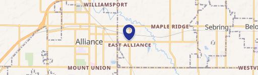
Location Insight
- Map
- Local Demand
- City
- Alliance
- County
- Stark
- State
- Ohio
- Longitude
- -81.1186
- Latitude
- 40.9464
- CBSA code
- 15940
- CBSA name
- CANTON-MASSILLON, OH METROPOLITAN STATISTICAL AREA
Property Tax & Assessments
Tax date
Tax Amount
Assessed Land Value
Assessed Improvement Value
Total Assessed Value
Applied Tax Rate
Land Market Value
Improvement Market Value
Total Market Value
2023
$33,207
$44,350
$622,930
$667,280
-
$126,700
$1,779,800
$1,906,500