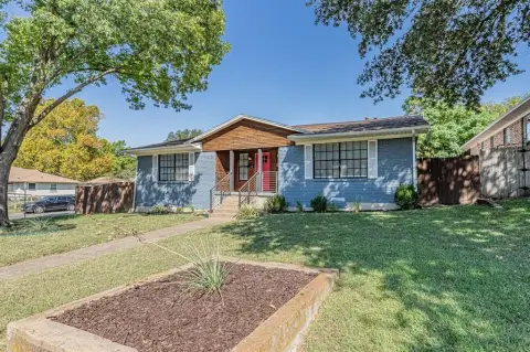
12150 Garland Rd Dallas, TX 75218-1533
Property profile & analytics
12150 Garland Rd Dallas, TX 75218-1533
- Manufacturing properties
- 12,780 SF
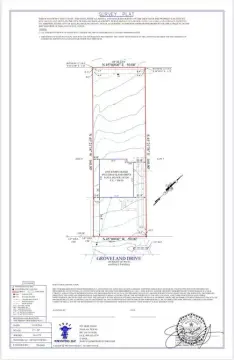
- 4.00 lot acres
Property ID
US83-4262400
The Realmo ID is a unique identifier assigned to every property, incorporating country codes and precise geo-coordinates for 300x300-foot land blocks. It enables standardized data collection and seamless integration of disparate sources such as ownership, tax, title data and physical specifications. By aggregating current and historical records, the Realmo ID powers advanced analytics and delivers deep, verifiable insights for real estate professionals.
Location Intelligence
Current Use by Public Records
- Waste Connections - Dallas / Waste Management Facility / Hazardous Waste Disposal
Property Details for 12150 Garland Rd
- Year built
- 1977
- Construction
- STEEL FRAME
- Lot size
- 4.00 lot acres
- Property size
- 12,780 SF
- Zone code
- Z239
- Property type
- Manufacturing properties
- APN
- 735790030000
- APU
- 735790030000
Value Estimations
based on Realmo’s proprietary methodology
-
AI approach
- Method
- Estimation
- ML approach
- $550,000
-
CAP approach
- CAP Return
- Estimation
- 6%
- $1,215,000
- 6.5%
- $1,120,000
- 7%
- $1,040,000
-
Comparable approach
- Method
- Estimation
- AI Estimate
- $864,000
Market price range: $263k - $864k -
Alternative Use
- Use
- Estimation
- RETAIL STORES
- $1,195,000
- NEIGHBORHOOD: SHOPPING CENTER
- $1,145,000
- MEDICAL BUILDING
- $865,000
- OFFICE BUILDING
- $850,000
Get a detailed, property-specific estimation — fast and free
Location Insight
- Map
- Local Demand
- City
- Dallas
- County
- Dallas
- State
- Texas
- Longitude
- -96.671
- Latitude
- 32.8621
- CBSA code
- 19100
- CBSA name
- DALLAS-FORT WORTH-ARLINGTON, TX METROPOLITAN STATISTICAL AREA
Property Tax & Assessments
Tax date
Tax Amount
Assessed Land Value
Assessed Improvement Value
Total Assessed Value
Applied Tax Rate
Land Market Value
Improvement Market Value
Total Market Value
2023
$39,011
$1,045,440
$654,560
$1,700,000
-
$1,045,440
$654,560
$1,700,000