
New search
Property profile & analytics
OFF-MARKET
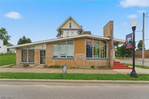
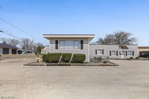
Retail space
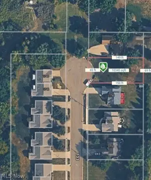
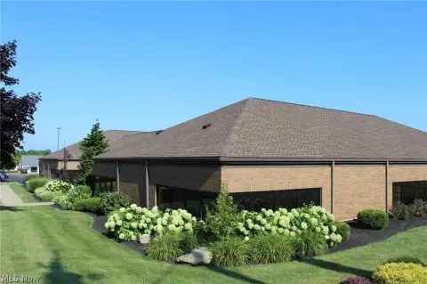
11621 State NE St, Alliance, OH 44601-8749
Entity Owned
2-yr Hold
~
Est. High Equity
Property ID
US66-0961949
Property profile
Verified
Property type
Retail space
Use group
RETAIL STORES (PERSONAL SERVICES)
Year built
1997
Construction
STEEL FRAME
Total area
2,560 SF
Lot
1.6 ac (69,696 SF)
APN
75-03033
UPID
US66-0961949
Cap rate & NOI
Priority signal for investors
Implied cap rate, NOI & suggested price
Cap rate vs submarket · NOI estimate · 3 price anchors
Implied cap rate, NOI & suggested price
Cap vs submarket · NOI estimate · 3 price anchors
Value estimations
Realmo proprietary · 4 methods
AI Approach
AI
by Request
CAP Approach
CAP
by Request
Comparable Approach
Comparable
by Request
Blend (final)
Blend
by Request
Owner & transaction history
Eco Energy Construction INC · 2 yrs held
Eco Energy Construction INC
since 2023
Last sale
$100,000
3 recorded transactions
Zoning & alternative use
Permitted uses
Permitted uses
Allowed · conditional · prohibited
Cap rate
Implied · in-place · derived from last sale + estimated NOI
Implied Cap rate
#1
Implied · in-place · NOI ÷ last sale
In-place · derived from last sale + estimated NOI
Cap rate, NOI & submarket benchmark
Implied cap rate vs Alliance submarket · NOI estimate · Typical band, median & reading
Implied cap rate, NOI & submarket benchmark
Cap vs Alliance submarket · NOI estimate · typical band, median & reading
Refine your cap rate
8-question underwriting flow
1.
Property current status — Going-In vs Stabilized
2.
Price for denominator — asking / offer / market
3.
Leasing status & lease structure (NNN / Gross)
4.
Tenant risk profile & vacancy assumption
5.
Upload T12 / rent roll / OM (optional)
Refine in 60 seconds, get exact suggested price
T12 upload · Submarket benchmarks · Sensitivity grid
Suggested price · 3 cap rate anchors
Income approach @ 5% / 7% / 9% — aggressive / typical / conservative
Suggested price at 5% / 7% / 9% cap
Aggressive / typical / conservative · Implied $/SF per anchor · Sensitivity grid
Suggested price at 5% / 7% / 9% cap
Aggressive / typical / conservative · implied $/SF · sensitivity
Value
AI, CAP & Alternative Use estimations · Realmo proprietary blendValue Estimations
Based on Realmo’s proprietary methodology
AI Approach
CAP Approach
Comparable Approach
Alternative Use
Get a detailed, property-specific estimation — fast and free
Price per SF
Sale + rent benchmarks
Subject property
—
Submarket sale & rent benchmarks
Median sale $/SF · Asking & closed rent · Submarket vacancy
Submarket sale & rent benchmarks
Median sale $/SF · asking & closed rent · submarket vacancy
Property tax & assessments
Tax year 2023Property tax & assessments
Tax year 2023
Tax billed
$1,706
Tax year 2023
Assessed value
$36,120
Assessed 2023
Previous assessed
$36,120
+0.0% YoY
Effective rate
4.72%
On assessed value
Assessed land
$20,370
Assessed improvement
$15,750
Land market value
$58,200
Improvement market value
$45,000
Total market value
$103,200
Applied tax rate
720.0000
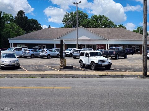
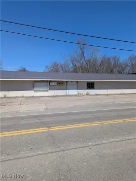
Comparables
6 recent transactions · within 1.5 miComparable in this city
6 recent transactions
Comparable in this City


Similar Nearby for Sale

Similar Nearby for Lease


Recent comparable sales
Sale price & price/SF · Sale date & distance · Adjustments & confidence
Recent comparable sales
Sale price & $/SF · sale date & distance · adjustments
Property description
Physical attributes from public recordsBuilding & lot
Public records
Property type
Retail space
Use group
RETAIL STORES (PERSONAL SERVICES)
Status
Off-Market
Year built
1997
Construction
STEEL FRAME
Heating
NONE
Cooling
NONE
Stories
1
Units
1
Bathrooms
0
Total area
2,560 SF
Lot
1.6 ac (69,696 SF)
APN
75-03033
UPID
US66-0961949
Jurisdiction
STARK
Zoning & alternative use
Zoning · permitted uses
Permitted & conditional uses
Allowed uses · Special-permit conditions · Prohibited uses
Permitted & conditional uses
Allowed · special-permit conditions · prohibited
Building & site characteristics
From public records
Year built
1997
Construction
STEEL FRAME
Heating
NONE
Cooling
Yes
Stories
1
Units
1
Bathrooms
0
Lot
1.6 ac
Current owner
From public records · entity-resolved
Eco Energy Construction INC
Entity
Mailing address
13420 THEELAND AVE NW, UNIONTOWN, OH 44685-9322
Ownership since
2023
Owner contacts — direct phone, email, and related entities
Decision-maker phone · Verified email · Related entities & filings
Owner contacts
Email · phone · related entities
Sales History
3 recorded events · public records
Date
Price
Buyer
Seller
Deed Type
Mortgage
Oct 20, 2023
$100,000
Eco Energy Construction INC
Sharon K Ray
Warranty Deed
$75,000 · Department Of Development Of The St
Jun 16, 2022
—
Sharon K Ray
Sharon K Ray
Intrafamily Transfer
related
—
Nov 23, 2004
—
Simmons Charles J & B J Trust
Simmons,charles J & Betty J
Quit Claim Deed
related
—
Coming soon
Costs & Benchmarks
Operating expenses, capex projections, utility benchmarks, and submarket comparables — all in one view.
Coming soon
Risks
Flood, climate, environmental, title, and tenant-concentration risk — surfaced with mitigations and source citations.
Try Rey
Ask anything about this address in plain English.
“Is 15.6% cap rate sustainable?” · “Best tenant mix for BU1?” · “What’s the redev upside?”
You own 11621 State NE St?
List it free. Reach 20,000 daily buyers.
We’ve already pulled the facts. Confirm photos + price and you’re live in 2 minutes.
List this address →
Full reports are paid
Unlock the full Property Analytics report
Start free for 7 days — no card required. Full owner contacts, all 4 valuations with methodology, refine flow, comparable adjustments, foot-traffic deep dive, export to PDF / CSV.


