11543 Rte 6th 6 Corry, PA 16407-8812
Property profile & analytics
11543 Rte 6th 6, Corry, PA 16407-8812
- Retail space
- 651 SF
- 0.29 lot acres
Property ID
US73-4028320
The Realmo ID is a unique identifier assigned to every property, incorporating country codes and precise geo-coordinates for 300x300-foot land blocks. It enables standardized data collection and seamless integration of disparate sources such as ownership, tax, title data and physical specifications. By aggregating current and historical records, the Realmo ID powers advanced analytics and delivers deep, verifiable insights for real estate professionals.
Location Intelligence
Current Use by Public Records
- Retail space
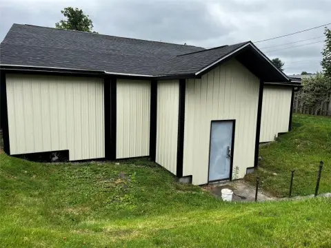
Property Details for 11543 Rte 6th 6
- Year built
- 1960
- Construction
- FRAME
- Lot size
- 0.29 lot acres
- Zone code
- B1
- Property type
- Retail space
- APN
- 12-002-002.0-005.00
- APU
- 12002002000500
Sales History
| Date | Price | Buyer | Seller | Deed Type | Mortgage |
|---|---|---|---|---|---|
| Dec 14, 2012 | $8,000 | Mazman LLC | Mercer Cnty St Bk | Grant Deed | — |
| Aug 6, 2012 | $2,647 | Mercer Cnty St. Bk | Sheriff Of Erie County | Trustees Deed · related | — |
| Jul 21, 2006 | $95,000 | James W Armagost | Steven W Mcgill | Special Warranty Deed | $60k · Mercer County State Bank |
Value Estimations
based on Realmo’s proprietary methodology
-
AI approach
-
CAP approach
-
Comparable approach
-
Alternative Use
Get a detailed, property-specific estimation — fast and free
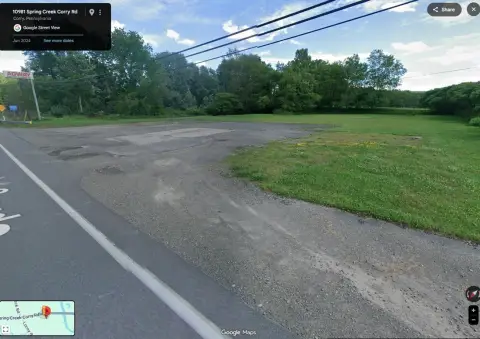
Location Insight
- Map
- Local Demand
- City
- Corry
- County
- Erie
- State
- Pennsylvania
- Longitude
- -79.7416
- Latitude
- 41.9179
- CBSA code
- 21500
- CBSA name
- ERIE, PA METROPOLITAN STATISTICAL AREA
Property Tax & Assessments
Tax date
Tax Amount
Assessed Land Value
Assessed Improvement Value
Total Assessed Value
Applied Tax Rate
Land Market Value
Improvement Market Value
Total Market Value
2023
$1,079
$20,500
$27,400
$47,900
-
$20,500
$27,400
$47,900