113 Hampton Rd Desoto, TX 75115-5741
Property profile & analytics
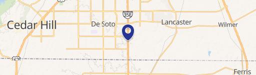
113 Hampton Rd Desoto, TX 75115-5741
- Commercial land
- 3,964 SF
- 0.42 lot acres
Property ID
US82-2955328
The Realmo ID is a unique identifier assigned to every property, incorporating country codes and precise geo-coordinates for 300x300-foot land blocks. It enables standardized data collection and seamless integration of disparate sources such as ownership, tax, title data and physical specifications. By aggregating current and historical records, the Realmo ID powers advanced analytics and delivers deep, verifiable insights for real estate professionals.
Location Intelligence
Current Use by Public Records
- Commercial land
Property Details for 113 Hampton Rd
- Year built
- 1978
- Construction
- MASONRY/CONCRETE MASONRY UNITS (CMUS)
- Lot size
- 0.42 lot acres
- Property size
- 3,964 SF
- Zone code
- Z97
- Property type
- Commercial land
- APN
- 20000500000270100
- APU
- 20000500000270100
Value Estimations
based on Realmo’s proprietary methodology
-
AI approach
-
CAP approach
-
Comparable approach
-
Alternative Use
Get a detailed, property-specific estimation — fast and free
Location Insight
- Map
- Local Demand
- City
- Desoto
- County
- Dallas
- State
- Texas
- Longitude
- -96.8574
- Latitude
- 32.589
- CBSA code
- 19100
- CBSA name
- DALLAS-FORT WORTH-ARLINGTON, TX METROPOLITAN STATISTICAL AREA
Property Tax & Assessments
Tax date
Tax Amount
Assessed Land Value
Assessed Improvement Value
Total Assessed Value
Applied Tax Rate
Land Market Value
Improvement Market Value
Total Market Value
2023
$0.00
$54,450
$0.00
$54,450
-
$54,450
$0.00
$54,450