Property profile & analytics
Hwy 67th S Walnut Ridge, AR 72476
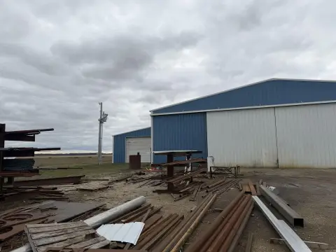
- Warehouses
- 4,900 SF
OFF-MARKET
Value Estimations
$255,000
Show details
Cap Rate Potential
Location Intelligence
Property ID
US05-1495835
The Realmo ID is a unique identifier assigned to every property, incorporating country codes and precise geo-coordinates for 300x300-foot land blocks. It enables standardized data collection and seamless integration of disparate sources such as ownership, tax, title data and physical specifications. By aggregating current and historical records, the Realmo ID powers advanced analytics and delivers deep, verifiable insights for real estate professionals.
Current Use by Public Records
- Warehouses
Property Details for Hwy 67th S
- Construction
- MASONRY/CONCRETE MASONRY UNITS (CMUS)
- Property size
- 4,900 SF
- Property type
- Warehouses
- Property subtype
- Self storage facilities
- APN
- 850-00968-001-C
- APU
- 85000968001C
Value Estimations
based on Realmo’s proprietary methodology
-
AI approach
- Method
- Estimation
- ML approach
- $255,000
-
Alternative Use
- Use
- Estimation
- WAREHOUSE, STORAGE
- $380,000 Current use
- AUTO REPAIR, GARAGE
- $390,000 Change: +2% Conversion: Easy
Get a detailed, property-specific valuation — fast and free
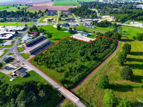
Location Insight
- Map
- Local Demand
- City
- Walnut Ridge
- County
- Lawrence
- State
- Arkansas
- Longitude
- -90.952
- Latitude
- 36.068
Property Tax & Assessments
Tax date
Tax Amount
Assessed Land Value
Assessed Improvement Value
Total Assessed Value
Applied Tax Rate
Land Market Value
Improvement Market Value
Total Market Value
2023
$1,484
$7,750
$25,014
$32,764
-
$38,750
$125,070
$163,820