
0 Hendricks County Rd, Mooresville, IN 46168
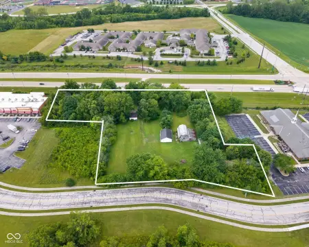
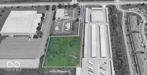
This exceptional 30.27-acre agricultural property in Hendricks County, Indiana, presents a compelling investment opportunity. Located near Plainfield, IN, with a Mooresville mailing address and zip code 46168 (APN: 321522400004000011), this land is currently utilized for farming, with existing tenant rights extending to the conclusion of the current crop season. The property is zoned for agricultural use, offering a multitude of potential development avenues. Its strategic location benefits from the proximity of municipal water and electricity, enhancing its versatility and appeal. The planned addition of an I-70 interchange in the vicinity promises significant future growth and increased property value. This makes this parcel an attractive option for both established agricultural operations seeking expansion and forward-thinking investors anticipating the area's development trajectory. The asking price for this expansive tract is $900,000. Serious inquiries are encouraged.
Cap rate
Implied · in-place · derived from last sale + estimated NOIValue
AI, CAP & Alternative Use estimations · Realmo proprietary blendComparables
6 recent transactions · within 1.5 miComparable in this City


Similar Nearby for Sale


Similar Nearby for Lease


Property description
Physical attributes from public recordsZoning & alternative use
No recorded transactions found for this property.
Costs & Benchmarks
Operating expenses, capex projections, utility benchmarks, and submarket comparables — all in one view.
Risks
Flood, climate, environmental, title, and tenant-concentration risk — surfaced with mitigations and source citations.


