
0 Laraway Rd, New Lenox, IL 60451
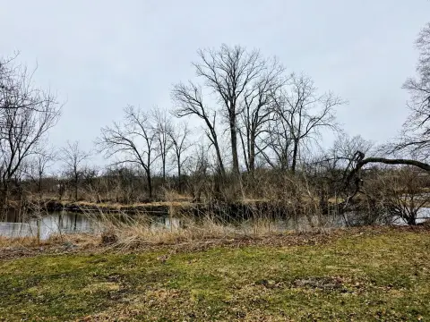
This exceptional 85.63-acre mixed-use property presents a unique investment opportunity in New Lenox, Illinois. Strategically located at the northeast corner of South Cedar Road and West Laraway Road, this expansive parcel boasts a highly desirable location just 36 miles from downtown Chicago, providing convenient access to major transportation arteries. The property's proximity to the I-80 and I-355 interchange ensures seamless connectivity, while its adjacency to the Metra station offers convenient commuter rail service directly to Chicago. The site is situated within the coveted Lincoln-Way West High School and Tyler Elementary School districts, adding significant appeal to potential residential developments. Currently zoned R-1 Single Family Residential, the property offers substantial potential for mixed-use development, allowing for medium to high-density residential projects. The substantial lot size allows for potential subdivision, maximizing development flexibility. Parcel numbers are 15-08-27-300-013 and 15-08-27-300-014. Annual property taxes are $21,948.04. The asking price is $1.00 per square foot. This is a rare opportunity to acquire a large, strategically located parcel with significant upside potential in a thriving community. Don't miss this chance to capitalize on the strong demand for residential and mixed-use development in this prime location.
Cap rate
Implied · in-place · derived from last sale + estimated NOIValue
AI, CAP & Alternative Use estimations · Realmo proprietary blendComparables
6 recent transactions · within 1.5 miComparable in this City


Similar Nearby for Sale


Similar Nearby for Lease


Property description
Physical attributes from public recordsZoning & alternative use
No recorded transactions found for this property.
Costs & Benchmarks
Operating expenses, capex projections, utility benchmarks, and submarket comparables — all in one view.
Risks
Flood, climate, environmental, title, and tenant-concentration risk — surfaced with mitigations and source citations.


