
Twp34N R10E, Elwood, IL 60421
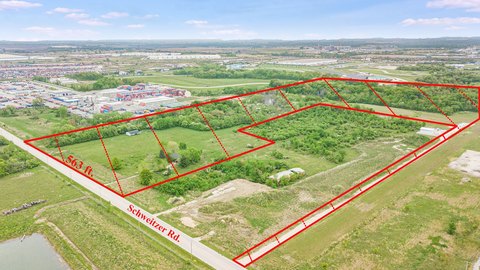
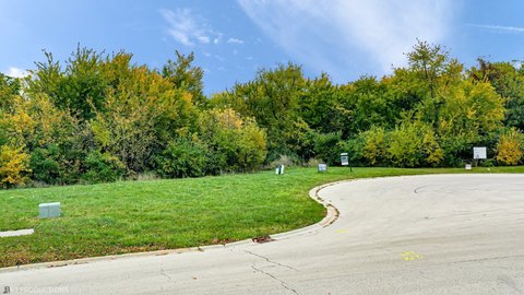
This exceptional 4.58-acre commercial land parcel presents a remarkable investment opportunity in Elwood, Illinois. Strategically located at the northwest corner of Route 53 and Mississippi Avenue, this property boasts unparalleled visibility for any business. Access is conveniently provided via Heritage Drive, ensuring easy ingress and egress. The property is offered fee simple, with an APN of 1011292060010000. Its prime location at a major intersection makes it ideal for a wide range of commercial ventures seeking high traffic exposure. The expansive lot size provides ample space for development, allowing for significant flexibility in design and construction. This is a rare opportunity to acquire a highly visible and strategically positioned commercial land parcel in a growing area. The asking price is $550,000. Don't miss this chance to secure a prominent location for your business. The property is zoned for commercial use (verification of zoning with local authorities is recommended). Detailed site plans and surveys are available upon request. This property is situated in Will County, Illinois, with a zip code of 60421. The coordinates are 41.4057538 latitude and -88.1096118 longitude.
Cap rate
Implied · in-place · derived from last sale + estimated NOIValue
AI, CAP & Alternative Use estimations · Realmo proprietary blendComparables
6 recent transactions · within 1.5 miComparable in this City


Similar Nearby for Sale


Similar Nearby for Lease


Property description
Physical attributes from public recordsZoning & alternative use
No recorded transactions found for this property.
Costs & Benchmarks
Operating expenses, capex projections, utility benchmarks, and submarket comparables — all in one view.
Risks
Flood, climate, environmental, title, and tenant-concentration risk — surfaced with mitigations and source citations.


