00 A Garrett, IN 46706
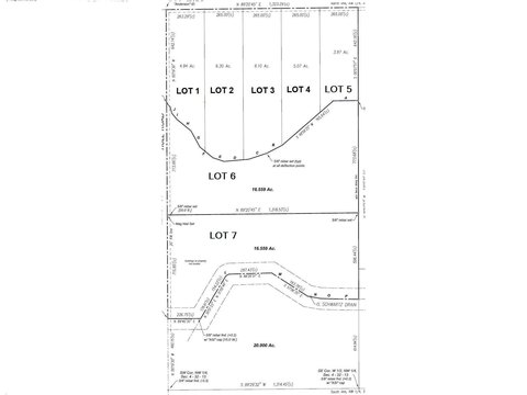
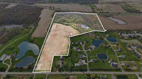
This exceptional 28.41-acre commercial land parcel presents a prime development opportunity. Strategically located at the I-69 exit at County Road 11A in Auburn, Indiana (Dekalb County, zip code 46706), this property boasts a high daily traffic count of 37,000 vehicles, ensuring significant visibility and accessibility. The lot, designated as Section A on the plot map, is part of the Auburn Hills subdivision and is zoned C-2p General Commercial District/Planned Unit Development, offering flexibility for various commercial ventures. All essential utilities, including city water and sewer, are readily available. The property's irregular shape encompasses 28.41 acres, providing ample space for substantial development. While the year built is listed as 1800, this refers to the subdivision's establishment, not the land itself. This is a blank canvas for your next commercial project. Note that parking is not currently included. Additional adjacent lots are also available for purchase separately.
Cap rate
Implied · in-place · derived from last sale + estimated NOIValue
AI, CAP & Alternative Use estimations · Realmo proprietary blendComparables
6 recent transactions · within 1.5 miComparable in this City


Similar Nearby for Sale


Similar Nearby for Lease


Property description
Physical attributes from public recordsZoning & alternative use
No recorded transactions found for this property.
Costs & Benchmarks
Operating expenses, capex projections, utility benchmarks, and submarket comparables — all in one view.
Risks
Flood, climate, environmental, title, and tenant-concentration risk — surfaced with mitigations and source citations.


