
5350 Clearbrook Ln, Roanoke, VA 24014
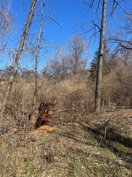
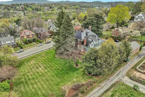
This exceptional commercial land opportunity presents three parcels available for development, strategically located in South Roanoke, Virginia, at 5350 Clearbrook Lane, zip code 24014. The property boasts a prime location on Highway 220, near the Blue Ridge Parkway, within a well-established retail trade area. This highly visible location benefits from significant traffic volume, with Franklin Road boasting an Annual Average Daily Traffic (AADT) count of 31,000 vehicles. The parcels offer varying sizes to accommodate diverse development needs: Lot 1 encompasses 1.33 acres, Lot 2 spans 1.42 acres, and Lot 3 comprises a substantial 7.53 acres. Importantly, initial site development work has already been completed, streamlining the development process and potentially reducing upfront costs for future projects. This presents a unique chance to capitalize on the strong retail presence and high traffic counts in this thriving South Roanoke location. The property is zoned for commercial use and offers significant potential for a variety of retail or commercial ventures. Contact us today to learn more about this exceptional investment opportunity.
Cap rate
Implied · in-place · derived from last sale + estimated NOIValue
AI, CAP & Alternative Use estimations · Realmo proprietary blendComparables
6 recent transactions · within 1.5 miComparable in this City


Similar Nearby for Sale


Similar Nearby for Lease


Property description
Physical attributes from public recordsZoning & alternative use
No recorded transactions found for this property.
Costs & Benchmarks
Operating expenses, capex projections, utility benchmarks, and submarket comparables — all in one view.
Risks
Flood, climate, environmental, title, and tenant-concentration risk — surfaced with mitigations and source citations.


