
0 36.34291455956586 -119.27442751282672, Visalia, CA 93292
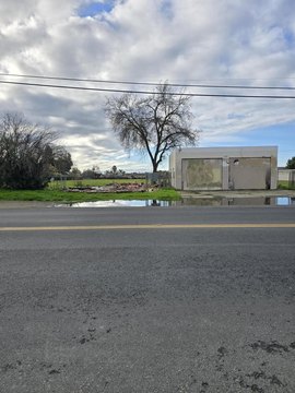
This 3.43-acre parcel, located at the northwest corner of Houston Avenue and Cain Street in Visalia, California (zip code 93292), presents a compelling residential development opportunity. The property is zoned RM-2, allowing for a density of up to 15 dwelling units per acre. Utilities are conveniently located on adjacent Cain Street. This lot is part of a recently approved and recorded four-parcel master planned development. Two parcels within this development are zoned for medium-density multifamily, and two are zoned commercial. The property's strategic location, just off Ben Maddox Avenue, a major Visalia arterial, offers excellent visibility and accessibility. A significant advantage is the proximity to a planned 16,800 square foot medical office building, which is expected to generate considerable activity and enhance the area's appeal. This site is ideal for owner-operators, investors, or merchant developers seeking to capitalize on the anticipated growth spurred by the nearby commercial projects. The land is priced at $8.70 per square foot. The property may be purchased separately or in conjunction with Parcel #4.
Cap rate
Implied · in-place · derived from last sale + estimated NOIValue
AI, CAP & Alternative Use estimations · Realmo proprietary blendComparables
6 recent transactions · within 1.5 miComparable in this City


Similar Nearby for Sale


Similar Nearby for Lease


Property description
Physical attributes from public recordsZoning & alternative use
No recorded transactions found for this property.
Costs & Benchmarks
Operating expenses, capex projections, utility benchmarks, and submarket comparables — all in one view.
Risks
Flood, climate, environmental, title, and tenant-concentration risk — surfaced with mitigations and source citations.


