Parcel King Rd Woodhaven, MI 48183
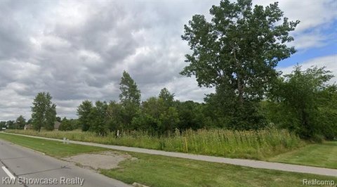
This exceptional 5.96-acre commercial land parcel presents a unique investment opportunity in Brownstown, Michigan. Ideally situated on King Road, this property boasts convenient access to major transportation routes, making it an attractive location for a variety of commercial ventures. The parcel is identified by APN 70-034-99-0013-704 and is zoned for commercial use (zoning information should be independently verified). Its expansive size offers ample space for development, allowing for flexibility in design and construction to suit diverse business needs. The property's location within Wayne County, Michigan, provides access to a robust workforce and established infrastructure. Prospective buyers are encouraged to conduct their own due diligence regarding zoning regulations, utility availability, and environmental considerations. This prime commercial land offers significant potential for growth and return on investment, making it an ideal acquisition for developers, investors, or businesses seeking to establish a strong presence in a thriving Michigan market. The property's address is listed as King Road Parcel, Brownstown, MI 48183, with GPS coordinates at 42.1552228 latitude and -83.221897 longitude. This is a rare opportunity to acquire a substantial commercial land parcel in a desirable location.
Cap rate
Implied · in-place · derived from last sale + estimated NOIValue
AI, CAP & Alternative Use estimations · Realmo proprietary blendComparables
6 recent transactions · within 1.5 miComparable in this City


Similar Nearby for Sale


Similar Nearby for Lease


Property description
Physical attributes from public recordsZoning & alternative use
No recorded transactions found for this property.
Costs & Benchmarks
Operating expenses, capex projections, utility benchmarks, and submarket comparables — all in one view.
Risks
Flood, climate, environmental, title, and tenant-concentration risk — surfaced with mitigations and source citations.


