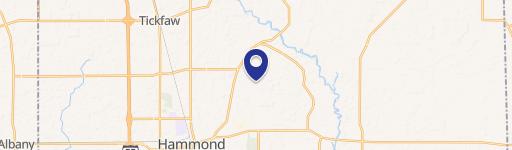
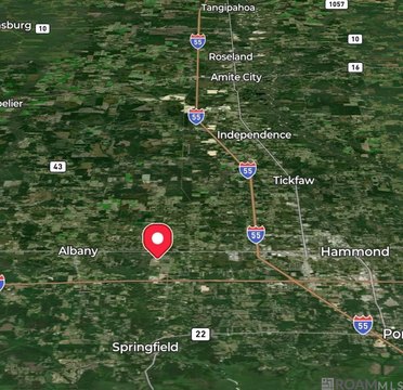
0 Rufus Bankston Rd Hammond, LA 70401
This exceptional 30-acre corner lot presents a unique investment opportunity in Hammond, Louisiana. Located at the northeast corner of Rufus Bankston Road and W. Kohnke Hill Road, this expansive parcel boasts 1,320 feet of road frontage, offering significant development potential. The property's versatile zoning allows for a variety of uses, including agricultural, residential, and industrial development, making it an ideal choice for a diverse range of projects. Its rural setting provides a tranquil atmosphere while remaining conveniently located near Hammond's amenities and infrastructure. The property's Assessed Parcel Number (APN) is 904708.000000000000000. With its substantial size and strategic location, this land offers exceptional flexibility for future development plans. The asking price for this remarkable property is $450,000. Serious inquiries are encouraged to explore the possibilities this unique offering presents. The property is located in Tangipahoa Parish, Louisiana, with a Hammond, LA 70401 zip code. This is a rare opportunity to acquire a large, versatile tract of land in a desirable location.
Cap rate
Implied · in-place · derived from last sale + estimated NOIValue
AI, CAP & Alternative Use estimations · Realmo proprietary blendComparables
6 recent transactions · within 1.5 miComparable in this City


Similar Nearby for Sale


Similar Nearby for Lease


Property description
Physical attributes from public recordsZoning & alternative use
No recorded transactions found for this property.
Costs & Benchmarks
Operating expenses, capex projections, utility benchmarks, and submarket comparables — all in one view.
Risks
Flood, climate, environmental, title, and tenant-concentration risk — surfaced with mitigations and source citations.


