V/L .18 ac N Straits Highway lot 2, Cheboygan, MI 49721

LAND - Cheboygan, MI
- Added:
- Jun 24, 2026
- Days on Market:
- 4
- Last Refresh:
- Jun 27 at 3:06 am
Property Features for V/L .18 ac N Straits Highway lot 2
General Information
- Property type
- Land
- Property subtype
- Other
- Standard status
- Active
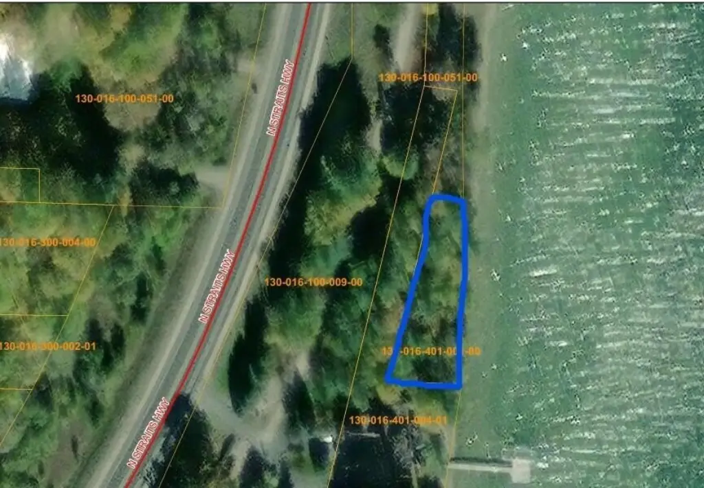
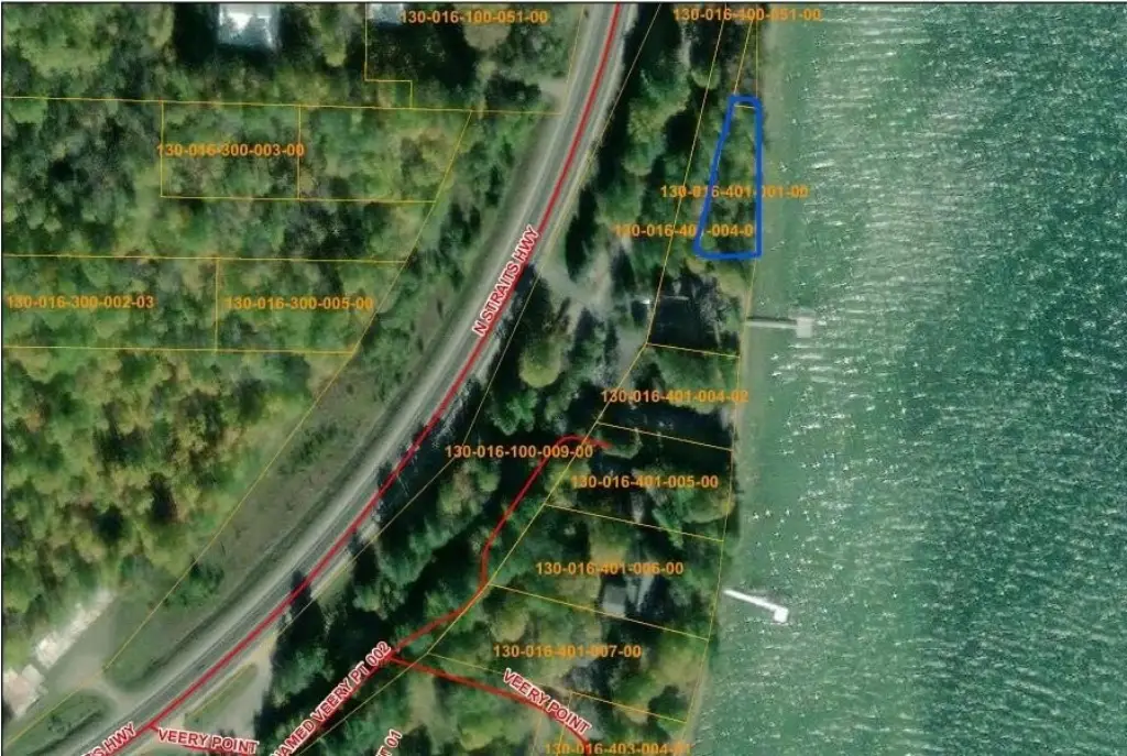
- APN
- 130-016-401-001-00
Taxes and HOA fees
- Tax Description
- N 166FT OF GOVT LOT 2, SEC 16, T36N, R2W, LYING ELY OF ELY R/W LI OF RR & EXTENDING TO SHORE OF MULLETT LAKE. 1108/471;1402/487
Utilities
- Water front
- 1
Listing agent Sandra Bradford (734) 890-2264
Listing office Real Estate One Indian River 6220 M-68, Indian River, MI (231) 238-2026
Listing date Jun 24, 2026
Copyright © 2026 Water Wonderland Board of Realtors®. All rights reserved. All information provided by the listing agent/broker is deemed reliable but is not guaranteed and should be independently verified.
HighLights
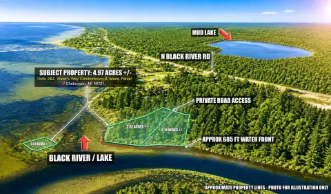
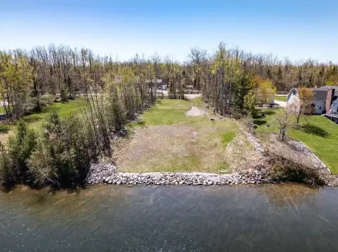
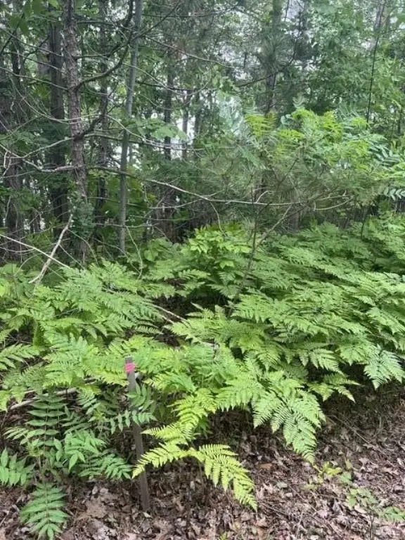
- 162' of shoreline on Mullett Lake with west‑shore access to the Inland Waterway system
- Access to the entire Inland Waterway from this Mullett Lake location
- Adjacent to the North Central State Trail for biking, hiking, and winter snowmobiling
- Property may be subject to building restrictions under current EGLE and County Health Department requirements—buyer to verify buildability and permits
Overview
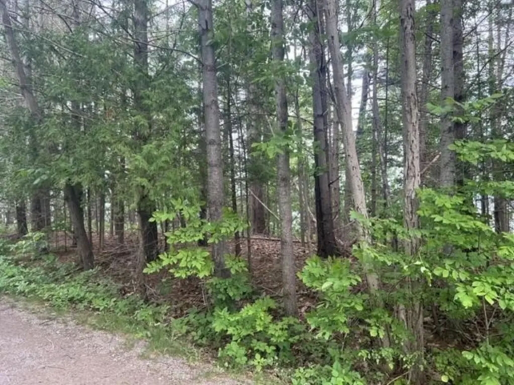
The property is described as adjacent to the North Central State Trail, supporting year-round outdoor use such as biking and hiking, as well as winter snowmobiling. The site is positioned in the Cheboygan area, with proximity noted to Topinabee, Indian River, Cheboygan, and I-75.
Because preliminary information indicates the lot may be subject to building restrictions under current EGLE and County Health Department requirements, prospective buyers should verify buildability, permits, and intended use during due diligence. This land opportunity is best suited for buyers evaluating a Northern Michigan waterfront project who are prepared to confirm regulatory constraints and shoreline-related permitting requirements prior to investing in development plans.
Current Use by Public Records
Map
- City
- Cheboygan
- County
- Cheboygan
- State
- Michigan
- Longitude
- -84.558318
- Latitude
- 45.510737