
Lafayette County Road 27 N, Stamps, AR 71860
- Added:
- Feb 3, 2025
- Days on Market:
- 519
- Last Refresh:
- Jul 7 at 12:06 pm
Property Features for Lafayette County Road 27 N
General Information
- Property type
- Land
- Property subtype
- Other
- Standard status
- Active
- Lot size
- 55.00 Acres
Taxes and HOA fees
- Tax Annual Amount
- 86
Utilities
- Sewer type
- Septic Tank
- Water source
- Public
Listing agent Bobby Hall (870) 901-3579
Listing office Bobby Hall Realty LLC 1707 Eastridge Drive Suite D, Magnolia, AR (870) 901-3579
Listing date Feb 3, 2025
Copyright © 2026 My State MLS. All rights reserved. All information provided by the listing agent/broker is deemed reliable but is not guaranteed and should be independently verified.
HighLights
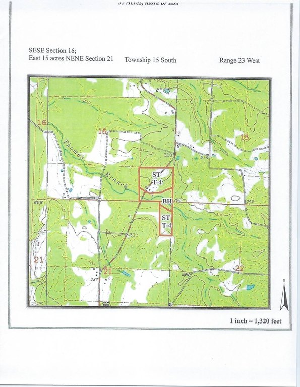
- Two tracts of land for sale on both sides of Lafayette County Road 27 in the rolling hills north of Stamps, Arkansas
- North tract: 40 acres in 16‑15‑23
- Southeast tract: 15 acres in 21‑15‑23
- Thomas Branch runs through the southern part of the 40 acres
- Water source: public; sewer: septic tank
- Mineral rights do not convey; January 2025 timber inventory and valuation available upon request
Overview
The property is located on both sides of Lafayette County Road 27 in the rolling hills north of Stamps, Arkansas. The tracts are identified as 16-15-23 for the 40-acre North tract and 21-15-23 for the 15-acre Southeast tract.
These tracts can fit buyers seeking separate parcels for farming, forestry, or holding land for future plans, with a natural water feature impacting part of the larger tract. Interested parties should plan to review the timber inventory and valuation available upon request and confirm how the non-conveyance of mineral rights aligns with their intended use.
Current Use by Public Records
Map
- City
- Stamps
- County
- Lafayette
- State
- Arkansas
- Longitude
- -93.487433
- Latitude
- 33.434481


