S Badger Lane lot 38, Arkdale, WI 54613
- Added:
- Jun 1, 2026
- Days on Market:
- 11
- Last Refresh:
- Jun 11 at 10:06 pm
Property Features for S Badger Lane lot 38
General Information
- Property type
- Land
- Property subtype
- Other
- Zoning
- Residentia
- Standard status
- Active
- APN
- 018-01063-0137
- Lot size
- 1.14 Acres
Taxes and HOA fees
- Tax Year
- 2025
- Tax Description
- Lengthy
- Tax Annual Amount
- 300
Utilities
- Sewer type
- None
- Water source
- Well Needed, None
- Water front features
- Lake
Listing agent Beata Zimon-Franczyk License #5611890 (608) 548-6900
Listing office Castle Rock Realty 104 W State St. (CC), Mauston, WI (608) 847-6020
Listing date Jun 1, 2026
Copyright © 2026 REALTORS® Association of South Central Wisconsin. All rights reserved. All information provided by the listing agent/broker is deemed reliable but is not guaranteed and should be independently verified.
HighLights
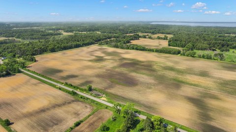
- 1.14‑acre wooded lot in the Petenwell Lake recreational area
- Lake frontage access via deeded access to Petenwell Lake (Wisconsin’s 2nd largest lake)
- Walking path nearby leads toward the lake for easy shoreline access
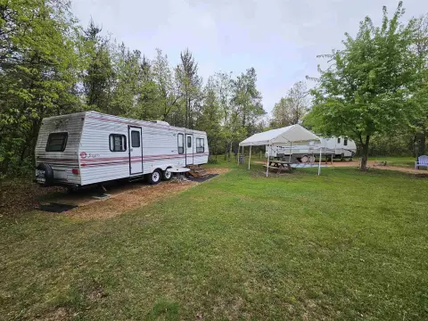
- Located in Petenwell Landing with limited camping allowed per covenants
- Protective covenants help maintain the neighborhood
- Surrounded by ATV/UTV routes and snowmobile trails, with nearby public land for recreation
Overview
The land is situated in Petenwell Landing and is governed by protective covenants intended to help maintain a quiet, attractive neighborhood. The area is described as being surrounded by ATV/UTV routes and snowmobile trails, along with nearby public land, which can support year-round outdoor activities. The property is zoned Residentia.
For buyers looking for wooded acreage with lake access, this site supports immediate recreation through permitted limited camping and offers a straightforward setting for future cabin or getaway development, subject to the applicable covenants. The adjacent lot 39 is also available under MLS 2018293, which may appeal to buyers considering additional space alongside this parcel.
Current Use by Public Records
Map
- City
- Arkdale
- County
- Adams
- State
- Wisconsin
- Longitude
- -89.9196633
- Latitude
- 44.1441209