
DeSoto Levee Drive, Arkansas City, AR 71630
- Added:
- Oct 31, 2025
- Days on Market:
- 240
- Last Refresh:
- Jun 27 at 11:06 pm
Property Features for DeSoto Levee Drive
General Information
- Property type
- Commercial Sale
- Property subtype
- Other
- Vegetation
- Wooded
- Standard status
- Active
- APN
- 001-01568-000
- Lot size
- 120.00 Acres
Taxes and HOA fees
- Tax Description
- W1/2 SW1/4 15 AC IN RIVER + NW1/4 NW1/4 OL
- Tax Annual Amount
- 183
Utilities
- Sewer type
- Septic Needed
- Water source
- Well Needed

Listing agent Stewart Nance License #SA00078543 (870) 688-7100
Listing office The Griffin Company Commercial Division-Springdale 5100 S Thompson, Springdale, AR (479) 756-1003
Listing date Oct 31, 2025
Copyright © 2026 ArkansasONE MLS. All rights reserved. All information provided by the listing agent/broker is deemed reliable but is not guaranteed and should be independently verified.
HighLights
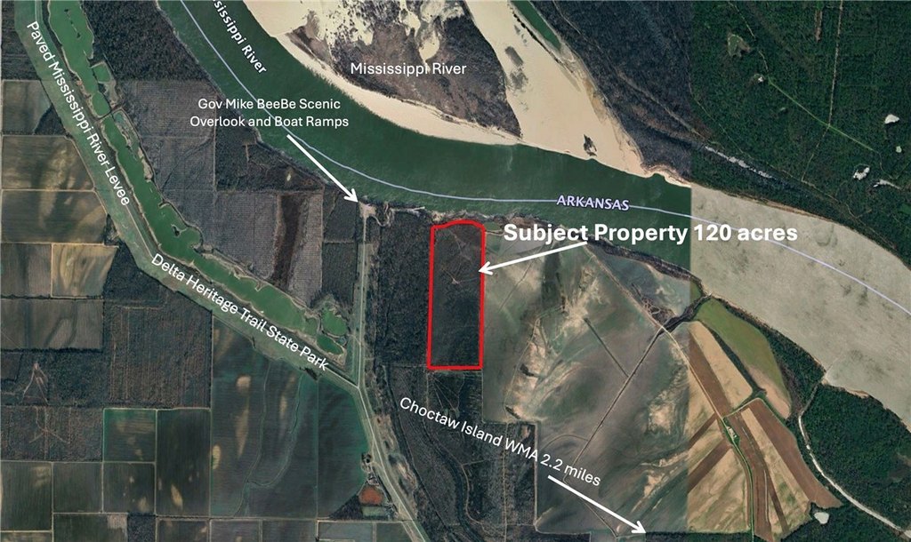
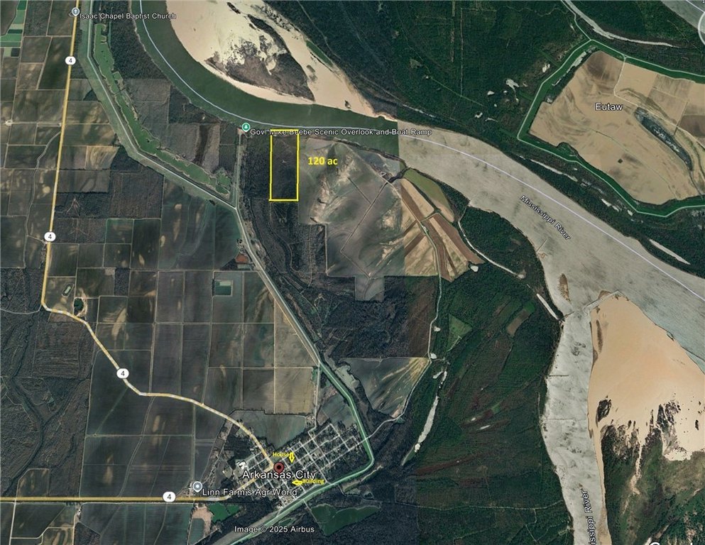
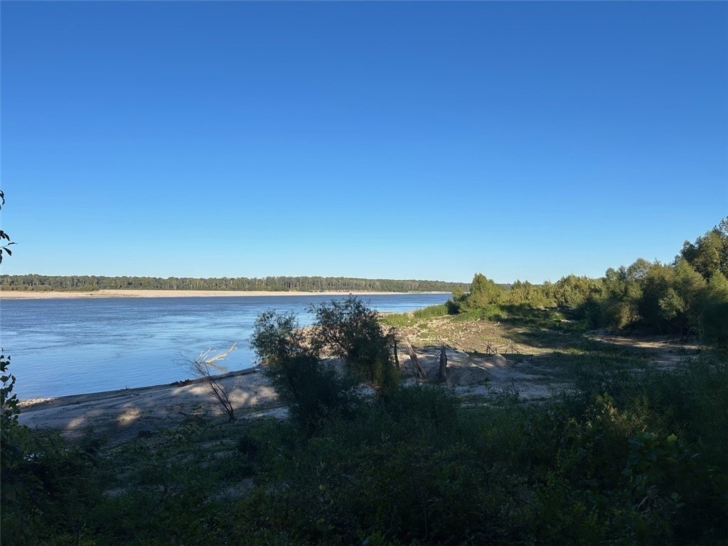
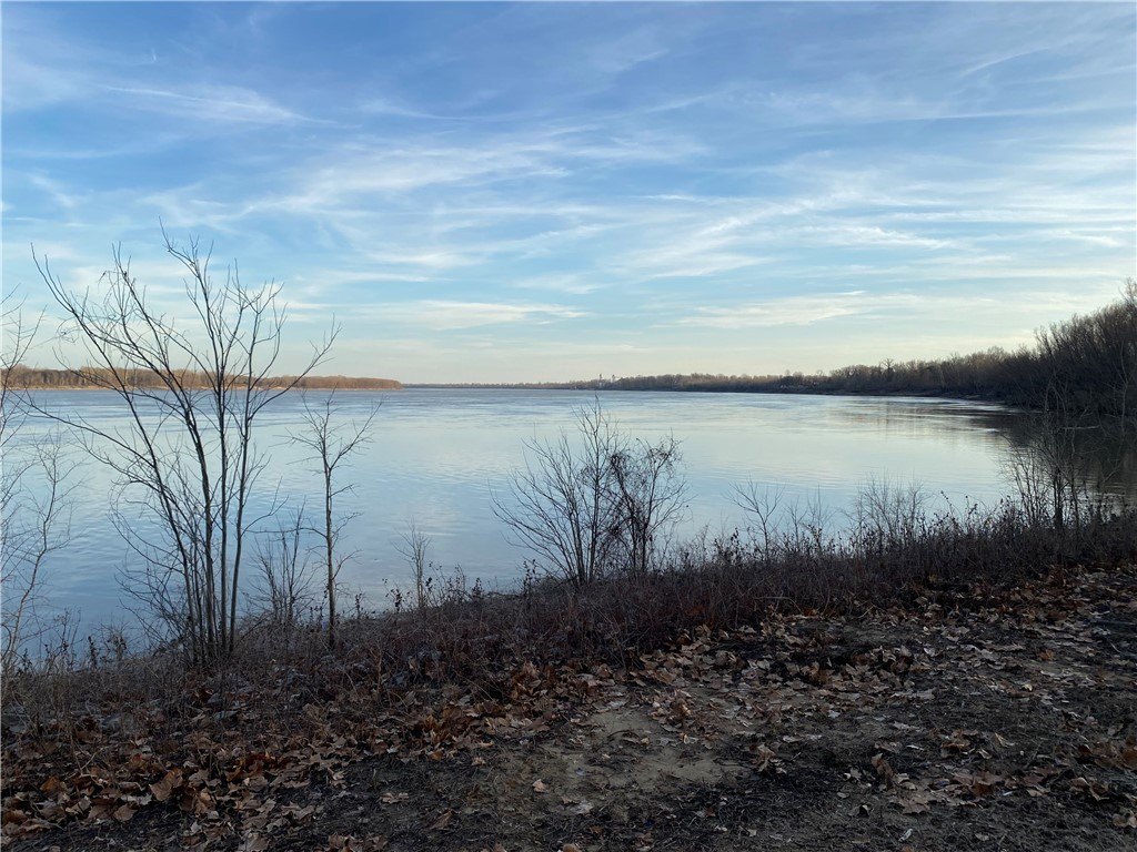
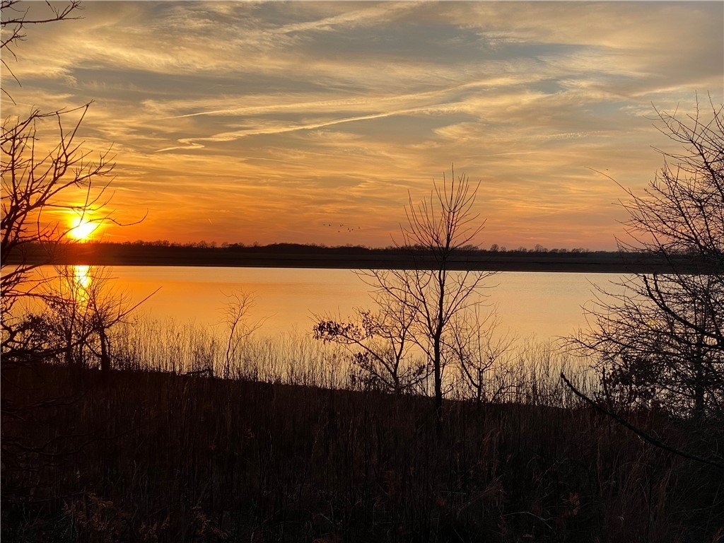
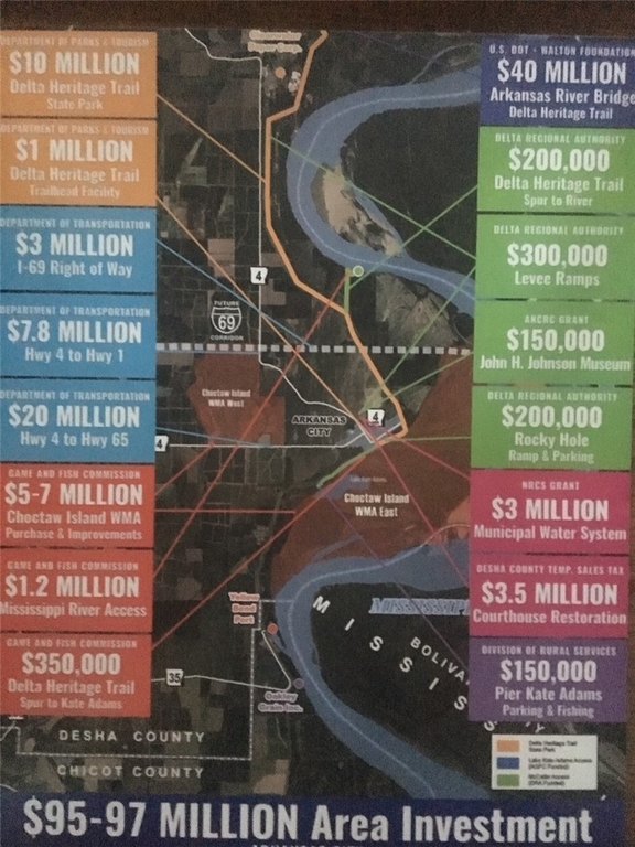
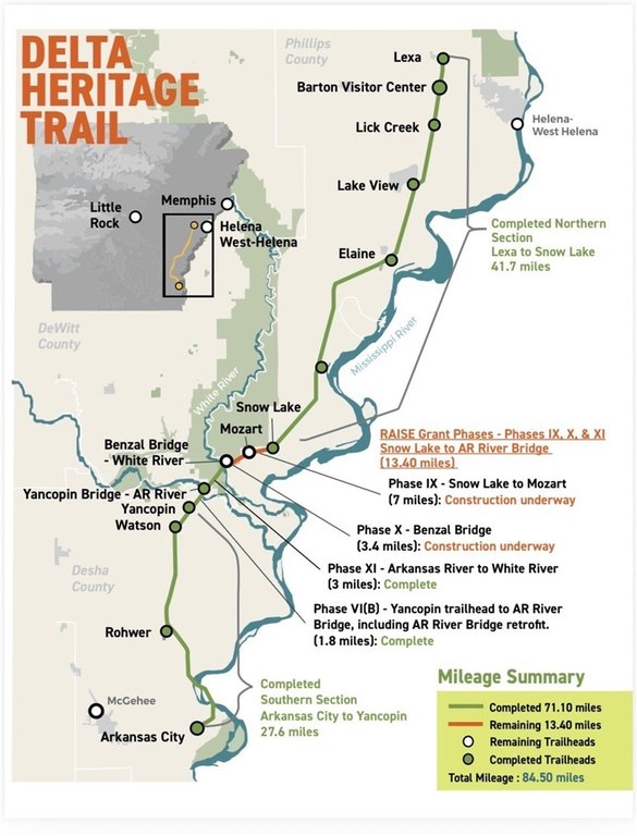
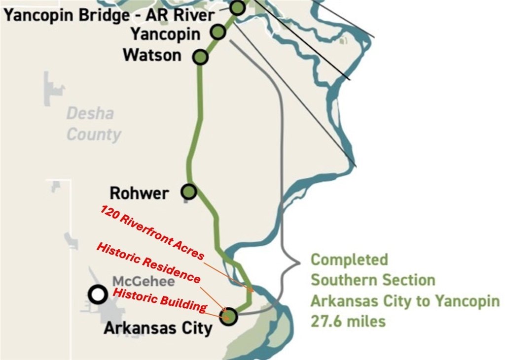
- Prime Mississippi River frontage recreational land at the south end of Delta Heritage Trail State Park
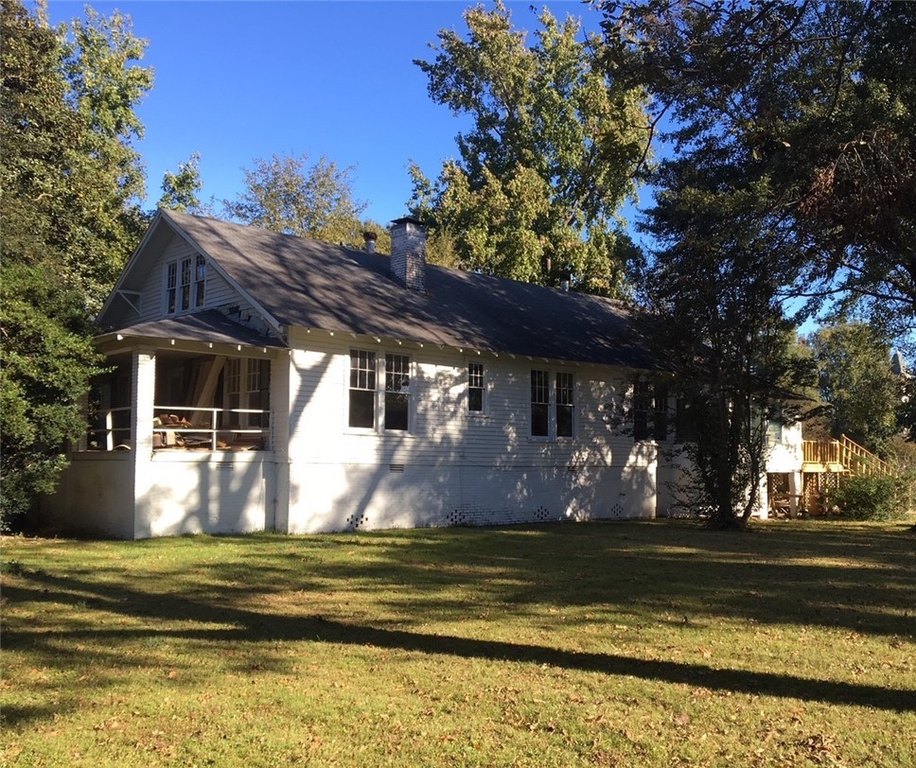
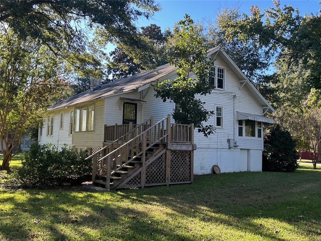
- Includes 120‑acre parcel and a downtown residence (parcel 003‑00115‑000); price includes both
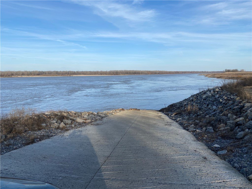
- Only paved Mississippi River public boat ramps south of Helena (70 miles) that accommodate small and large watercraft
- Adjacent Delta Heritage Trail (DHT) soon to be completed
- Near 10,000‑acre Choctaw Island Wildlife Management Area for hunting, fishing, biking, birdwatching, hiking, camping, and horseback riding
- Water source requires a well; sewer requires septic
Overview
The public remarks describe proximity to major area river access improvements, including a Governor Mike Beebe Scenic Overlook and a boat ramp, identified as the only paved Mississippi River public boat ramps south of Helena (70 miles), with capacity for both small and large watercraft. The remarks also note the soon-to-be completed adjacent Delta Heritage Trail, and that the nearby 10,000-acre Choctaw Island Wildlife Management Area supports public hunting and a range of outdoor activities.
For buyers looking for recreational or outdoor-oriented acreage, the site configuration is positioned for uses such as hunting, fishing, birdwatching, hiking, and camping, with nearby opportunities for biking and horseback riding referenced in the public information. The included downtown residence offers an added option for an on-site presence while holding the land for passive use or income-producing activity tied to the included residential parcel.
Current Use by Public Records
Map
- City
- Arkansas City
- County
- Desha
- State
- Arkansas
- Longitude
- -91.205152
- Latitude
- 33.648656


