Anderson Hollow Drive, Osage Beach, MO 65065
- Added:
- Sep 13, 2024
- Days on Market:
- 647
- Last Refresh:
- Jun 21 at 6:06 am
Property Features for Anderson Hollow Drive
General Information
- Property type
- Land
- Property subtype
- Other
- Standard status
- Active
- APN
- 08803400000000003000
- Lot size
- 348.00 Acres
Taxes and HOA fees
- Tax Year
- 2023
- Tax Description
- Parcel numbers 088.034.0000.0000003.000, 088.033.0000.0000001.000, 088.033.0000.0000056.000, 088.033.0000.0000001.001, 088.033.0000.0000076.000, 088.033.0000.0000077.000, 088.033.0000.0000078.000, 088.033.0000.0000079.000, 088.033.0000.0000080.000, 088.034.0000.0000009.000, 088.034.0000.0000008.000
- Tax Annual Amount
- 1113
Listing agent MATTHEW JAMES SCHRIMPF License #2002032212 (573) 434-6026
Listing office BHHS Lake Ozark Realty 101 Crossings West Drive Suite 202, Lake Ozark, MO (573) 365-6868
Listing date Sep 13, 2024
Copyright © 2026 Bagnell Dam Association of Realtors. All rights reserved. All information provided by the listing agent/broker is deemed reliable but is not guaranteed and should be independently verified.
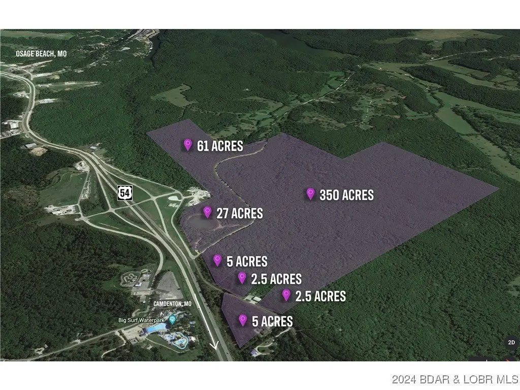
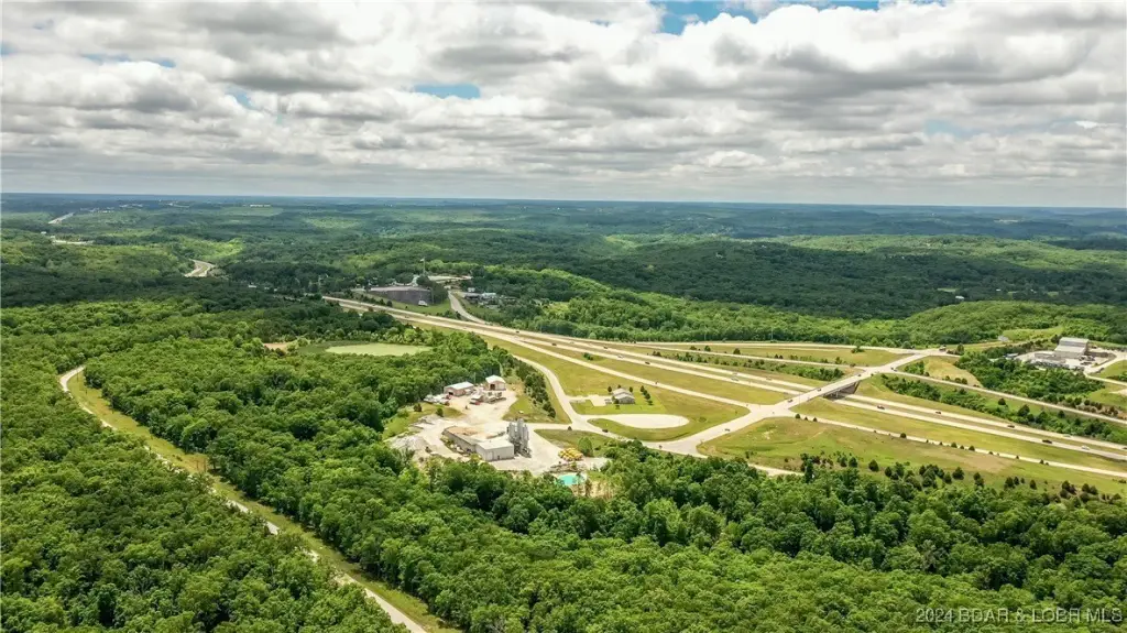
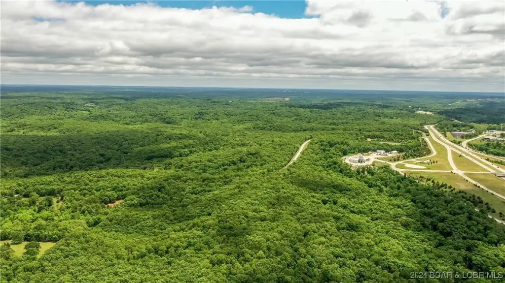
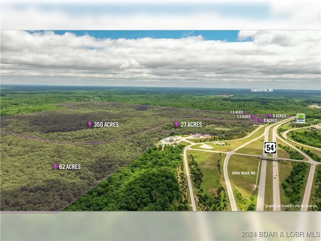
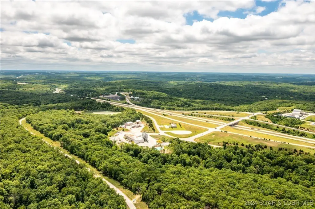
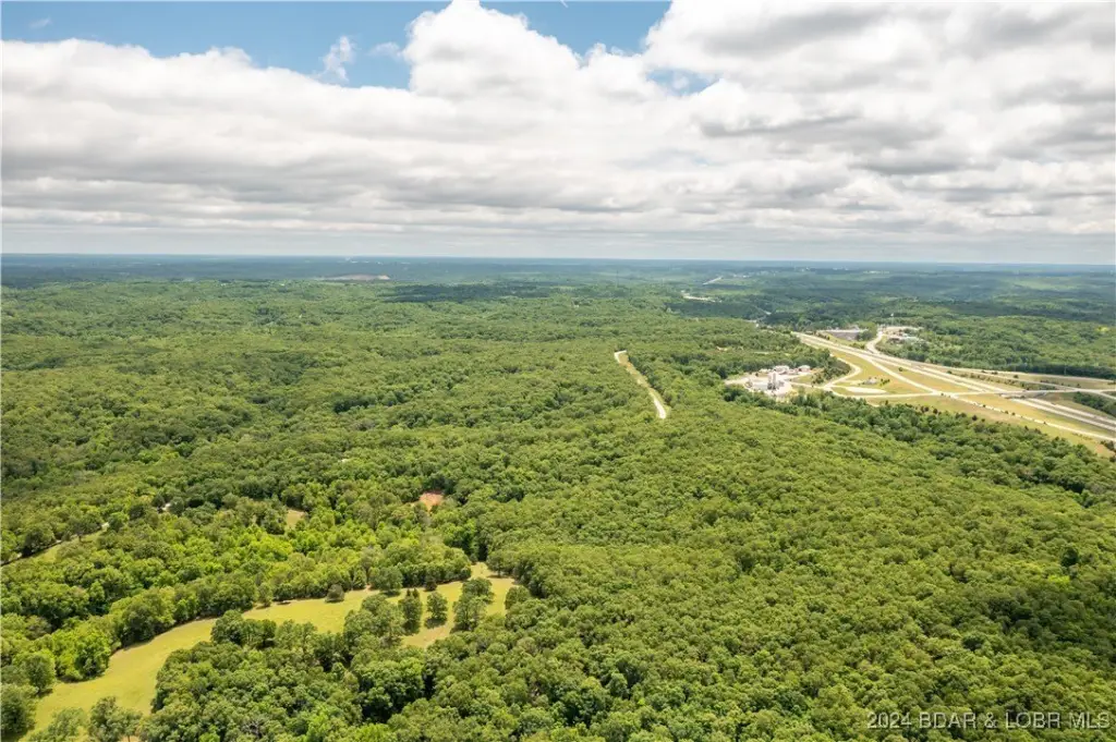
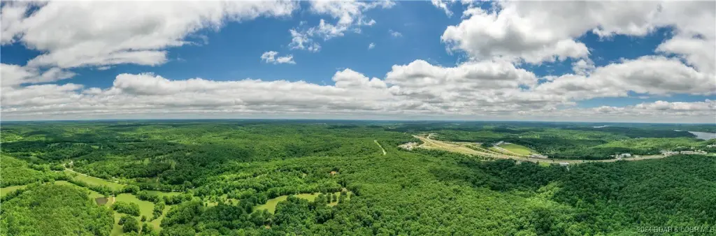
HighLights
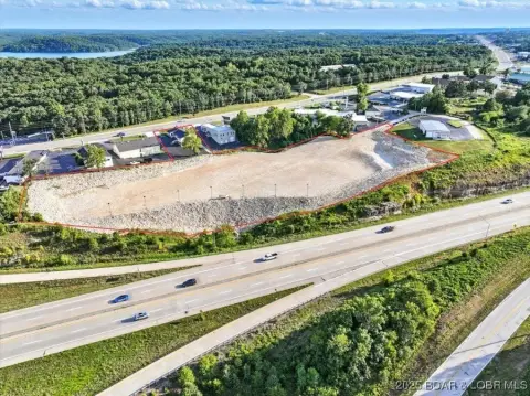
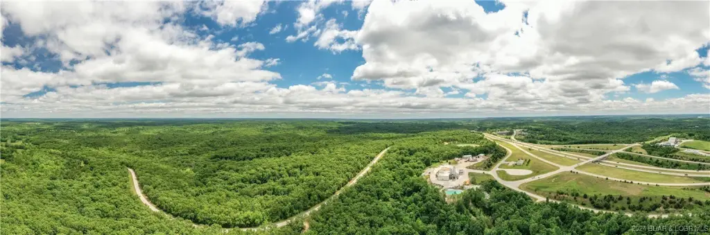
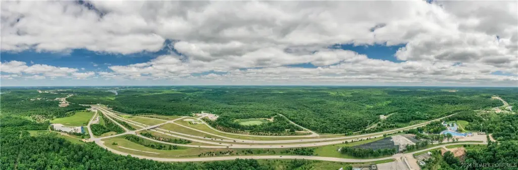
- 425 acres of prime development land with US Hwy 54 Expressway frontage.
- Located between Camdenton and Osage Beach at a US 54 Expressway interchange.
- High traffic count and excellent visibility.
- Suitable for mixed‑use development (commercial and residential).
- Owner will subdivide or sell as a whole.
- Topography suitable for creating lakes.
Overview
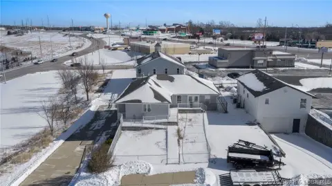
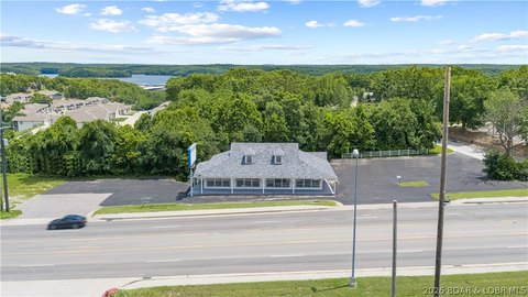
The site is positioned between Camdenton and Osage Beach at a US 54 Expressway interchange. Public remarks also note US Hwy 54 Expressway frontage directly across from Big Surf Water Park, with the property outside Osage Beach city limits.
For developers and land buyers looking for a sizable parcel with highway interchange access, this offering provides a framework for mixed-use concepts while maintaining flexibility on whether to market the land as a whole or in separate segments. The noted frontage and accessibility along US 54 are intended to support visibility and straightforward access for future site planning and development.
Current Use by Public Records
Map
- City
- Osage Beach
- County
- Camden
- State
- Missouri
- Longitude
- -92.683212
- Latitude
- 38.072405